The Beginning of Route 66
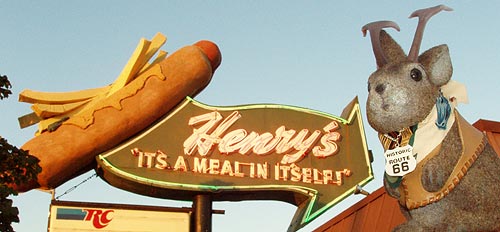
It's as much an ending as a beginning, really. But I suppose the ghost of manifest destiny and the leftover "whoosh" of the dust bowl migrants compels me to think of Route 66 as an east to west journey. Ride along for an evening, won't you? We'll stop for a giant hot dog later, I promise.
First part of the Ace does Illinois Route 66 series
This is a time-line of the first few hours of a five-day trip on Illinois Route 66 I took this past summer with Ace Jackalope and my lovely significant other. It was July 5 and we had just finished up a four-day stay in Ohio with a big July 4th the night before. We dashed from Dayton to Chicago, arriving just in time for the afternoon rush hour.
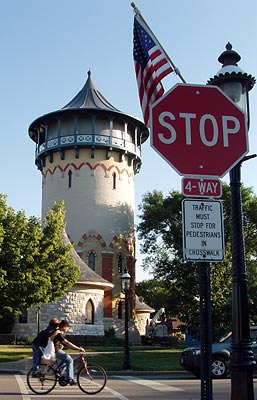
After a photo mission at the Brookfield Zoo, we drove south through the community of Riverside, encountering this castle-like structure - not on Rt66 - but worth a look because we'd see more of this sort of architecture.
I am noting the time stamp on my photos so that others driving this route can get a rough idea of the time needed to drive this section of the mother road on a weekday evening. Although most of the pictures in this post were actually shot from a moving car, we did stop a few times for better photos and twice for food, so your mileage may vary. This reminded me of a day in August of 2005 in which we sought to race the sun across the Mojave on a California stretch of Route 66, but in the case of Chicago, neon eye candy compensated for losing daylight views of buildings.
We were approaching Il66 from north of Lyons and decided to use the remaining hours of the day to scope out the Chicago area so we turned east and began what felt like an ascent up Ogden Avenue toward Chicago and the beginning of the mother road. I don't know if anyone but another Rt66 "roadie" can appreciate this, but I was really excited as I'd never seen any of Il66 at all and it was my last unexplored state for that route.
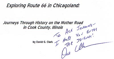
We started this trip with more and better maps and guidebooks than I'd had for any of my previous Route 66 trips. For this particular stretch, my main navigational aid and post-trip research aid was a hot-off-the-press copy of David G. Clark's "Exploring Route 66 in Chicagoland." I'll refer to Clark in this post when I've gleaned information from his book. I also used "Traveling The New, Historic Route 66 of Illinois" by John Weiss and "Route 66: EZ66 Guide for Travelers
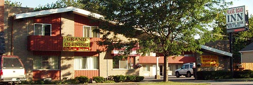
6:43 PM: Our first bit of IL66 pavement was in Lyons, west of Chicago. Ogden runs SW to NE and cuts a diagonal swath through maps of the Chicago area, accounting for much of Rt66 in the Chicago area, which is darn convenient for navigation. This photo was a case of "shoot it now, figure it out later" in that I wondered about the name "Plank Road Inn." Post-trip research showed that the name harkens back to the Southwestern Plank Road - literally, a road made of stringers and planks - that helped enable the Chicago of the 1848 to become accessible over the oft-muddy prairie soil that mired wagons. The Southwestern Plank Road was the first of several plank roads radiating from Chicago and initially ran from Chicago to Lyons, terminating at Ogden and Joliet Road, just a few blocks from here. Yep, part of what eventually became Route 66 must have looked like a boardwalk.
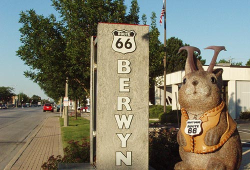
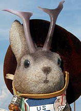
6:59 PM: This was the first visual link between what I'd read about and what I was actually seeing; I chose it for the initial photo of Ace Jackalope on Illinois Route 66. This Route 66 sign, between Wisconsin and Maple Avenues on the south side of Ogden, normally has backlit glass bricks but it was apparently being worked on. The very 66-proud city of Berwyn has these at both ends and we'd see a working one tonight on the way back through here.
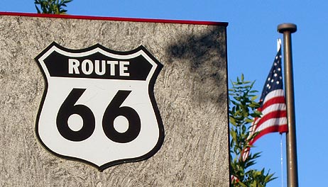
We saw a lot of American flags on this trip; I thought this was a nice pairing of icons.
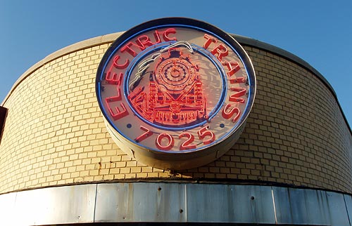
7:06 PM: Berwyn's Toys, Trains and Models had the first cool neon sign I'd see on IL66.
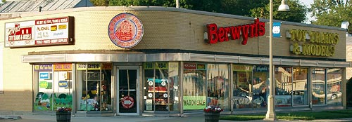
Berwyn's is at 7025 Ogden Avenue, the corner of Ogden Ave and Wenonah, in - of course - Berwyn. I was reminded of Original Whistle Stop train store in Pasadena. I think it's neat that there are model train stores with nice neon signs in the suburbs at both ends of Route 66.

7:20 PM: I sometimes photograph buildings that aren't that interesting to me, but that reader emails have taught me are appreciated. Such is the case with anything that looks like it might be an old service station. This is Cassidy Tire and Service, 7000 West Ogden, the SW corner of Ogden and Home Avenue in Berwyn.
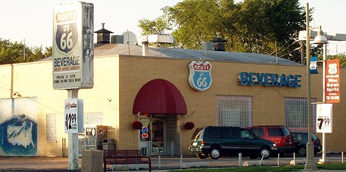
7:22 PM: Route 66 Beverage, 6847 Ogden Ave, Berwyn, is a liquor store, not the bottling plant for the Route 66 soft drinks, as I'd first hoped. There is a Route 66-inspired mural of the U.S. painted on the side of the building.
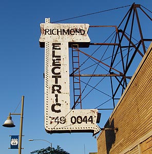
7:32 PM: Richmond Electric, 6416 W Ogden, Berwyn. You never forget you're on Rt66 while on this stretch of Ogden through Berwyn. How could you, with all those attractive blue RT66 banners hanging from the light poles?
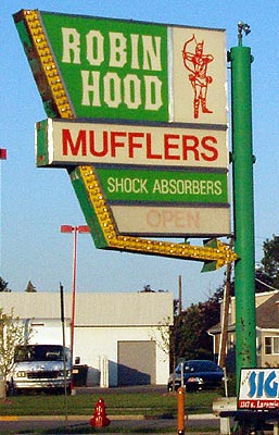
7:34 PM: The next town on our voyage toward Chicago was Cicero, where we found Robin Hood Mufflers on the south side of Ogden at 61st Court.
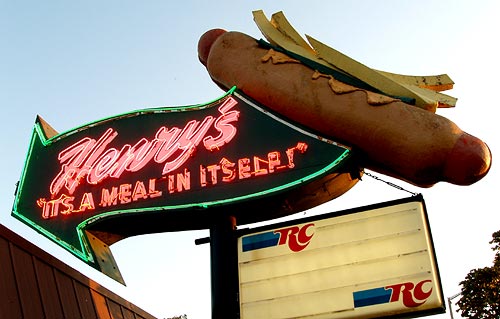
7:36 PM: Henry's Drive-in was our first food stop, and the giant hot dog sign made a nice photo-op with Ace (top of post). I'm impressed by giant food; I'm just shallow that way. Of course, ya gotta eat at any place with giant food. I mean, that's just a basic rule of roadside exploration...right? Henry's is at 6031 W Ogden Ave, Cicero, on the south side of Ogden, west of 60th Court.
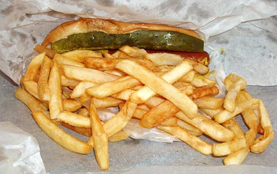
I'm told this was a standard hot dog for the area. Believe it or not, there's a wiener under the pickle spear and fries.
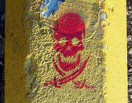
You know you're in a big city when you see enigmatic stuff spray stenciled onto parking blocks and such. Maybe there was some local significance or perhaps someone was just crazy about pirates.
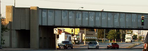
8:01 PM: This is a railroad overpass just east of Henry's. I liked the sculpting at the left end.
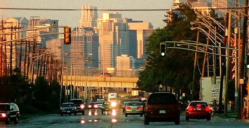
By the time we left Henry's at about 8:05 PM, we could see the orange glow of the westering sun glinting off the skyscrapers of Chicago to the NE, as we gazed up Ogden.
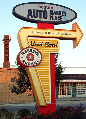
8:10 PM: I google the names of businesses when I compose posts like this one. Usually they are pretty much what I expect, but Seguin Auto Marketplace Used Cars at the corner of Central & Ogden Avenues in Cicero turns out to be a place where your donated or consigned car is used to help adults and children with disabilities. I've found some references to Robert Andreas as a Republican Committeeman in Cicero, but I don't know if it's the same one as mentioned on the sign.
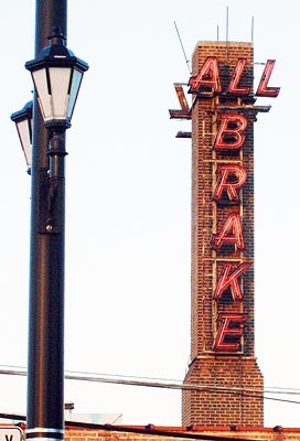
8:10 PM: This nice bit of vertical neon belongs to All Brake, 5551 W Ogden Ave, Cicero, on the south side of Ogden, west of 55th Avenue. I've read they've been in business since 1936.
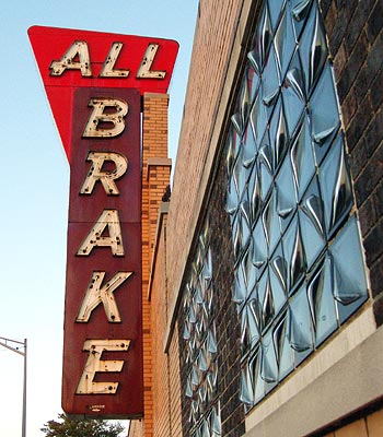
All Brake also has this neato neon sign.
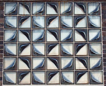
And they have a type of glass brick I had not seen.
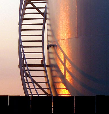
8:11 PM: These industrial tanks were on north side of Ogden across from All Brake.
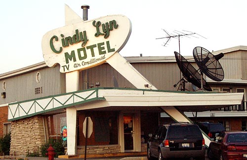
8:22 PM: Cindy Lyn Motel is at 5029 W Ogden in Cicero. The few reviews of it I've seen have been positive. I got a better photo of the next day, which I'll use in a later post.
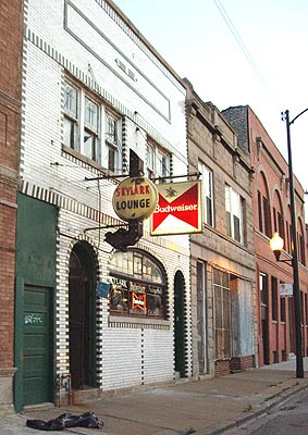
8:26 PM: I can find no online references to the Skylark Lounge; I liked the brickwork around it.
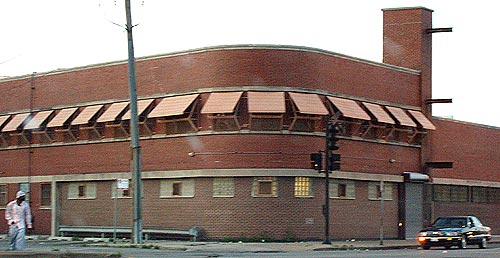
8:26 PM: An unidentified building close to the Cicero/Chicago border. I wasn't going to include this because of the blur; then I got an email from a model railroader telling me he searched my blog for building ideas and I figured this would be a nice older industrial building.
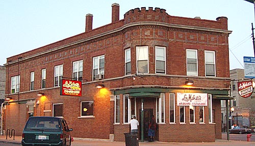
8:27 PM: Lou Malnati's Pizzaria, 3859 W Ogden Ave, Chicago is a Chicago-area pizza chain. Note the castle-inspired architecture at top. According to Clark, all profits from this store go to local schools in the North Lawndale neighborhood.
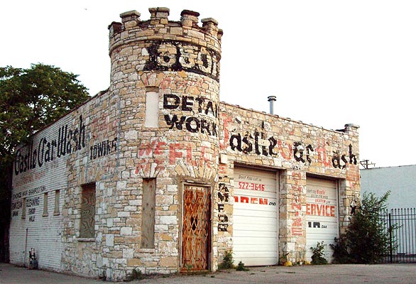
8:27 PM: The Castle Car Wash, 3801 Ogden, is at the east end of the same block as Lou Manati's. It dates from 1925 - before Ogden was Route 66 - and was originally a gas station. Here again, is a castle.
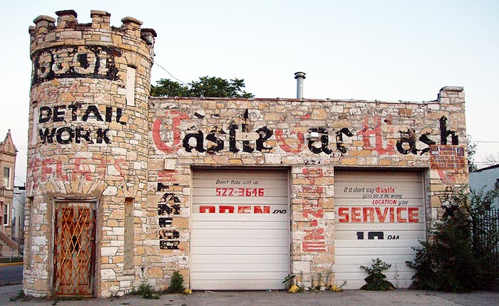
There's a good article on the Castle Car Wash by Dave Clark on an Illinois Route 66 Association page. The Castle Car Wash was not always known by that name and may not always have been a castle. Clark suspects that original owner John J. Murphy, who owned the place for at least 40 years, may have made the alteration in the 1940s.
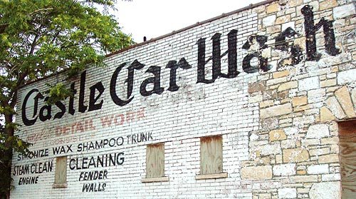
You can see a borderline; maybe this shows two eras of the building. After Murphy's ownership ceased, the building was S&B Standard Service, then Gas City and eventually the Castle Car Wash. It is closed now and preservationists are concerned for its future. Anyone out there need a castle? Sure, you know you do.
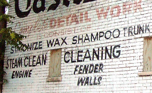
Maybe part of the lettering is missing, but it looks to me like it reads: "..is consist of.."
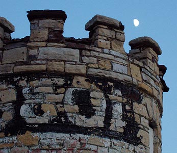
Why, oh why did I not have Ace's medieval attire handy?
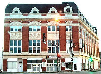
8:39 PM: It was growing dark by this time and shutter speeds would be just long enough to introduce some blur from the moving car. We had to budget our stops though, as it was usually a bit of problem to find a place to park, it'd been a long day already and we hadn't even checked into our motel. This ornate structure, is the Douglas Park Auditorium at Ogden and Kedzie Avenues, Chicago. It was built in 1910.
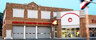
8:43 PM: Though I did not do justice to it, I rather liked the center part of this Firestone store at 1301 S Western Ave, along Ogden Avenue. There is a clock in that small red circle, I got a better shot the next day.
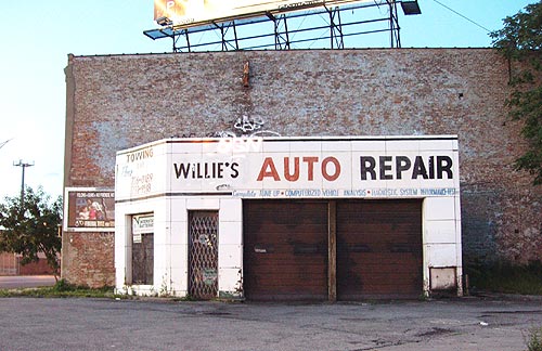
8:45 PM: Willie's Auto Repair at 2363 W Ogden Ave, Chicago, is dwarfed by the surrounding buildings. I bet it was an old service station.
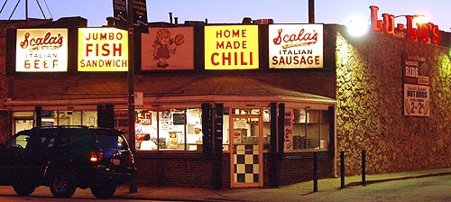
8:53 PM: Lu-Lu's at 1000 S Leavitt Street, on the north side of Ogden, looked interesting.
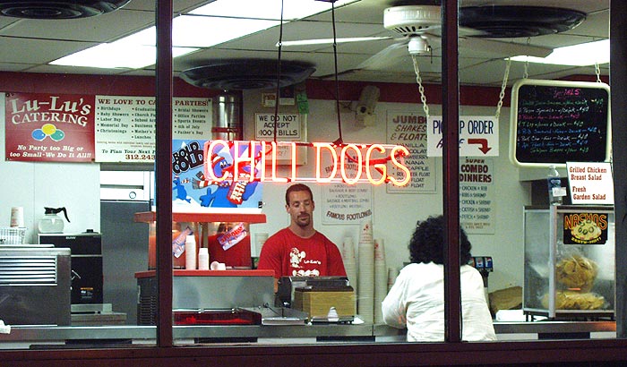
I couldn't resist a "peek in" shot.
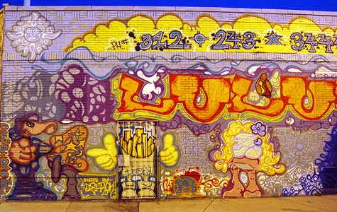
Murals on the side of LuLu's furnished a bit of color.
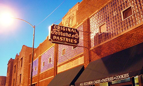
8:57 PM: Ferrara and Company Pastries, 2210 W. Taylor Street, isn't technically on Route 66 but it's close, being on a side street just off the north side of Ogden. I was drawn to it by the sign. The company was founded in 1908 and although this is not the original location, it sounds pretty neat according to a Chicago Tribune article. Too bad it was closed at the time we passed by.
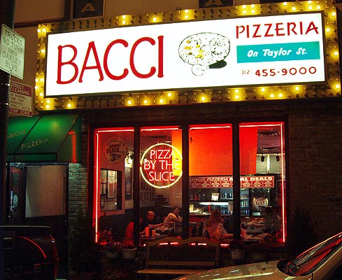
9:16 PM: My Lovely Significant other had a hankering for a Chicago-style pizza, and why not? We sated this desire at the nearby Bacci Pizzaria, 2248 W Taylor Street. It's a small chain with 14 locations in the Chicago area; this one was about a block and a half off Route 66. According to their website, we were in Little Italy.
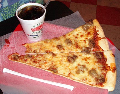
I usually shoot food pictures before I start to eat, but forgot and took a bite.
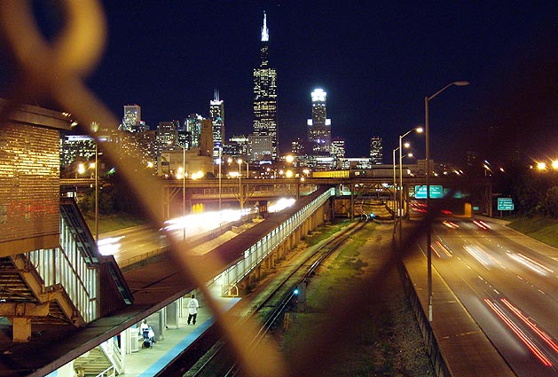
9:35 PM: We were back on 66, heading northeast up Ogden. If you like good cityscapes, I recommend this spot. It's by a mass transit station on a bridge along Ogden. The view is looking east toward downtown. Part of the mass transit system, as well as the Eisenhower Expressway, (Interstate 290) runs underneath.
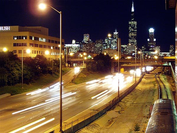
If you move over to the northeast of the station, there is a small area of concrete with no fence where you can set a camera for short time exposures. You won't even need a tripod if the bottom of your camera will set flat on the concrete.
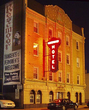
9:45 PM: Very soon after the I-90 crossing, Route 66 turns off the diagonal Ogden Avenue and goes east onto the one-way Jackson Blvd for the remainder of its eastward run. I can imagine the feeling of mixed excitement and loss of people traversing the whole of Route 66 from California to here. As it was, I had the rest of Illinois 66 west of Chicago to look foreword to. The first structure I saw that interested me was the Rosemoor Hotel, 1622 W Jackson Blvd.
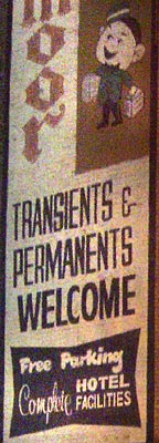
I loved the "Transients and Permanents Welcome" sign. Doesn't the bellboy look wholesome?
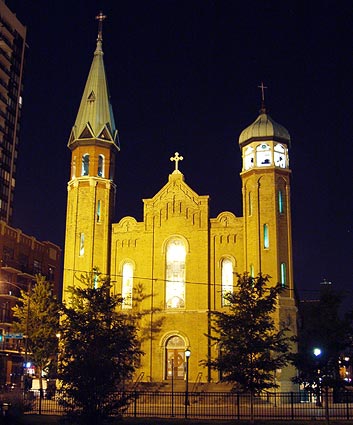
9:55 PM: We wandered about a block off-course for Old Saint Patrick's Church, 700 W Adams Street. Adams is also Route 66 but on the westbound one-way route a block to the north of Jackson Blvd. I couldn't resist stopping for a picture as soon as we saw it. The church was dedicated Christmas morning in 1856 and there is quite a bit of history information at their website.
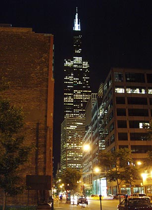
9:59 PM: This is a view east toward the Sears Tower from a park across from St Patrick's. The Sears tower is Chicago's most noted skyscraper, and it's on Route 66 between Adams and Jackson Streets. It was built in 1973 and was the world's tallest building until 1996. The local ABC TV affiliate has a set of webcams atop it.
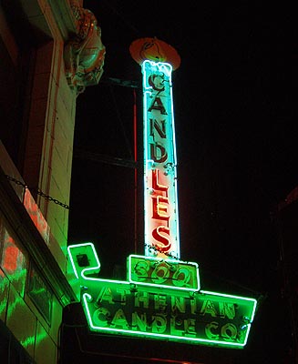
10:06 PM: Moving one block to the south, back to Jackson heading farther east, we encountered the neon sign for the Athenian Candle Company, 300 S Halstead Street. The Athenian Candle Company is the retail outlet for The Luck Shop, a store selling "lucky spiritual goods and cultural heritage products." According to Clark, the building housed a cafeteria in the 1920s and 30s.
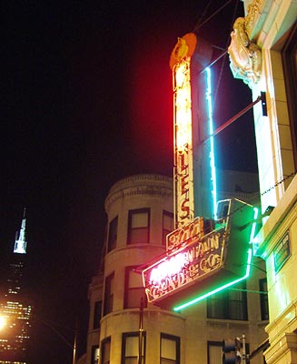
The south side of the sign was not working, which is too bad considering the nice background buildings.
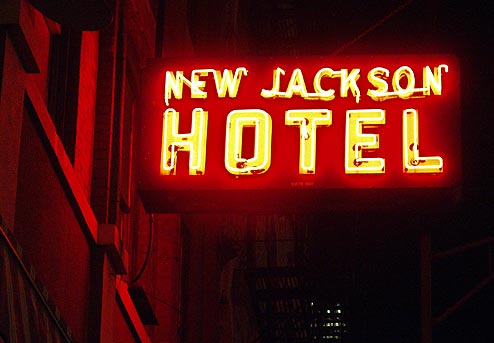
10:08 PM: The New Jackson Hotel, 768 West Jackson Blvd, is caddy-cornered from the Athenian Candle Company. The building is currently a residential hotel and houses at least one restaurant.
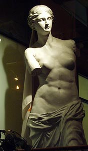
10:11 PM: This area of the loop is "Greek Town", noted for Greek restaurants and such. I believe this Venus belonged to a restaurant of the same name at 820 West Jackson.
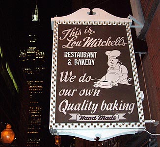
10:16 PM: Lou Mitchell's, 565 W Jackson Blvd, is a Chicago and a Route 66 institution; it has been in place since 1923.
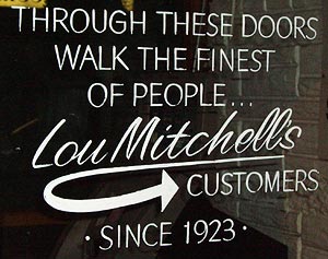
It is not open much after lunch, but we decided to come here for breakfast the next morning.
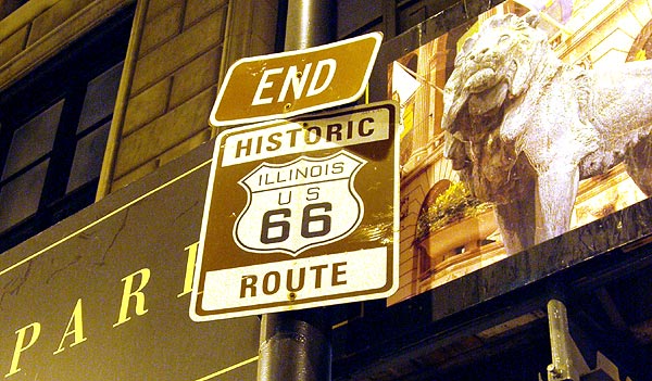
10:33 PM: Well, here it is (roadie "here it is" pun intended) - the sign near the corner of Jackson Blvd and Michigan Avenue that marks the eastern end of Route 66 - almost 2500 miles from the western end we'd visited last year near Santa Monica Pier. But you can't believe everything you read, even on official signage. To be perfectly accurate, this sign is actually two blocks west of the real end of Route 66.
Although Route 66 once did end here, that hasn't been the case since 1937, when the eastern end of 66 was moved two long blocks east to the intersection of Jackson and Lake Shore Drive ( Hwy 41). I do not know why the sign is here instead of in the correct place - perhaps Chicago authorities don't want people stopping at the busier Lake Shore Drive intersection? The last two blocks between the sign and the Jackson/Lake Shore Drive intersection were blocked off for the "Taste of Chicago" festival when we were there so we could not drive it.
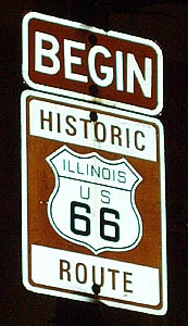
10:35 PM: We turned left onto Michigan and left again onto Adams Street, just one block from our previous eastward path on Jackson. We were now moving west on the one-way Adams. Near the corner of Adams and Michigan is this "Begin" sign for Route 66. This is another little complication; like the other end of Route 66, which we'd seen 11 months prior, this one takes some explaining. Route 66 was originally not here; it was on Jackson Street when Jackson was two-way. But when Jackson was made one-way heading east back in 1953, Adams, of necessity, became the westward Route 66 route until it hits Ogden Street after leaving the Chicago loop.
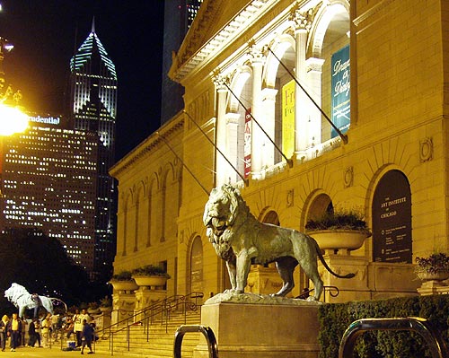
10:39 PM: We drove around in circles a few times at the end of Route 66, so the time stamps are less relevant after this. On one of those circles we passed the Chicago Art Institute, 111 S Michigan Avenue, which is on Michigan Avenue near Adams Street.
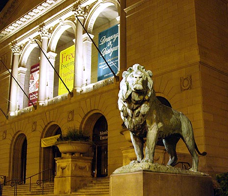
It's amazing how much clarity you can get in a picture taken from a car at night.
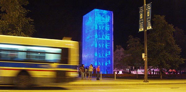
10:40 PM: A bus passes by a neat blue sculpture.
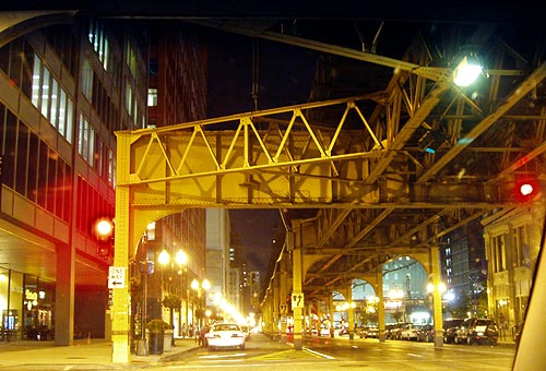
10:42 PM: Part of "the L" - Chicago's mass-transit system.
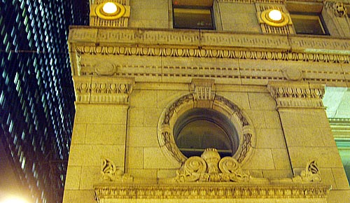
10:44 PM: building detail on Adams
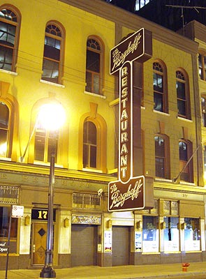
10:46 PM: We passed The Berghoff restaurant at 17 West Adams was a Chicago institution for 107 years.
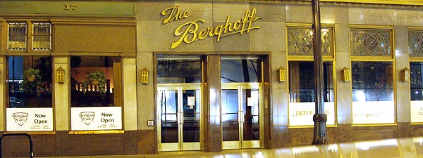
The original business is now closed but the sign remains and the building is used for The Berghoff Cafe and Artistic Events, both ventures run by the original owner's great grand-daughter.
After this, we decided to call it a night and head back to our hotel east of Chicago and north of route 66 for the night. We had, after all, started the day near Dayton, Ohio. We drove 66 from the loop all the way back to Lyons where we had to turn north, but didn't see any lit neon to pursue until we reached Berwyn.
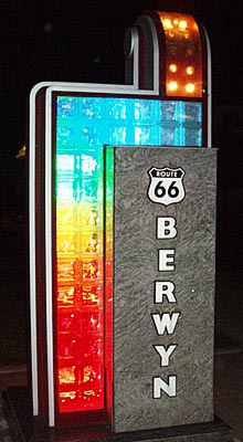
11:14 PM: On our way back to our lodgings west of Chicago, we passed through Berwyn again and basked in the neon and incandescent glow of the working Route 66 sign west of Lombard on the north side of Ogden.
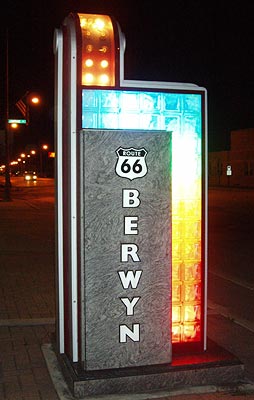
The little incandescent light bulbs chase in sequence over the top of the sculpture. Colored floodlights behind the glass bricks light from the bottom in red, yellow, green and blue.
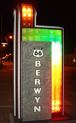
The green light behind the glass bricks is not as bright as the blue light, which is the next and last in the upward sequence. To get the green to show up, I had to shoot before the blue turned on.
It had been a long day that had started near Dayton, OH, and ended with a trip down much of Chicago-area Route 66. We'd return the next day and see more of it in daylight.
I'd like to thank:
Mia, for admirable urban commando driving
Rayne for the sweet hotel deal
Patsy and Steve for furnishing on-the-road info support
and Dave Clark for info used in this post

1 Comments:
http://www.bloggerschoiceawards.com/blogs/show/5943
Vote Ace!
Post a Comment
<< Home