The End of Route 66
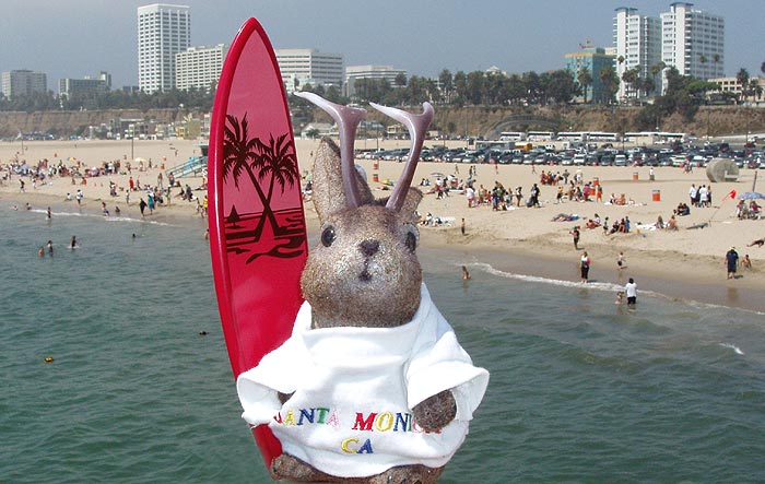
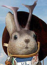
Ace Jackalope celebrates the end of a long, fruitful journey to the western end of Route 66.
 It was August 6 and we reached the end of our Route 66 journey; we returned with a different entourage on August 11.
And where, exactly, does Route 66 end?
 I've always seen Santa Monica Pier or Pallisades Park listed as the end, but, technically, the consensus seems to be that it ends at Lincoln and Olympic Boulevards, a few blocks inland. I was chatting about this with a friend at a restaurant, when serendipity dropped the answer in my lap. A lone gentleman on the booth behind me apologetically interjected that he's been listening and that he had lived for many years in Santa Monica, about which he spoke wistfully. I asked him, "where, technically, does Route 66 end?"
"At the park" he answered definitively, as if it had been silly for me to ask such an obvious question.
 So, there ya go. Tradition and affectionate regard win over technicality in my book, so, as far as Ace and I are concerned, Route 66 ends with Palisades Park and the Santa Monica Pier. Funny how we say it "ends" here rather than "begins" here; most of the guidebooks and websites treat Rt66 as an east-to-west journey. Maybe its an echo of the old dustbowl migration days.
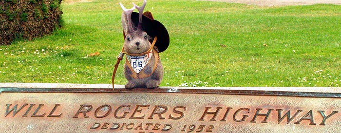
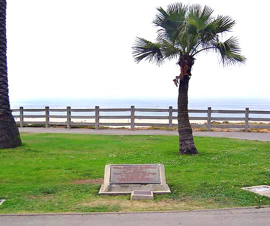
At the Northern end of Palisades Park you'll find this plaque.
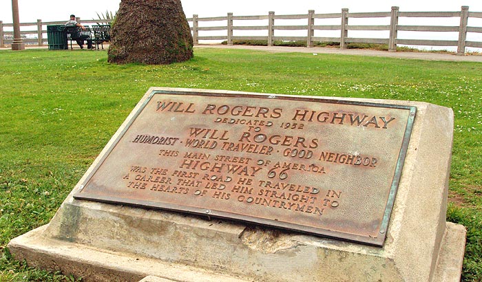 It bears the inscription: "Will Rogers Highway; Dedicated 1952 to Will Rogers; Humorist; World Traveler; Good Neighbor; This Main Street of America, Highway 66, was the first road he traveled in a career that led him straight to the hearts of his countrymen"
By the way, lest you think the pithy humor of Will Rogers outdated, I'd like to offer the following quotes:
"We always want the best man to win an election. Unfortunately, he never runs."
"A fool and his money are soon elected."
"If we ever pass out as a great nation we ought to put on our tombstone 'America died from a delusion that she had moral leadership'"
But, back to Route 66 and the plaque. It was placed here by Warner Brothers, Ford and the Main Street of America Association, not only to honor Rogers but as part of a publicity campaign for the 1952 movie The Story of Will Rogers. Not that we have any misgivings about adopting it as the our own personal end of Rt 66, but isn't it fitting that a city so associated with make-believe would have a plaque marking the end of a road where it isn't but where we would like to to be?
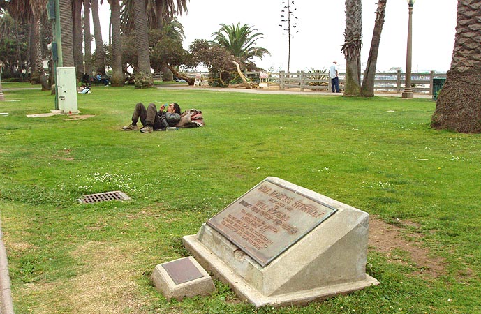 Palisades Park is beautifully landscaped with palm, oak, and eucalyptus trees lining paved and natural paths that run past gardens with exotic and native plants. It is also inhabited by homeless people. One of the days I was there, the homeless out-numbered the tourists; Michael Wallis wrote about a soup kitchen here in his book "Route 66, The Mother Road."
When I shot the picture below, I was thinking "what a cool looking place; maybe we should have stayed there instead of the Motel 6 in Hollywood."
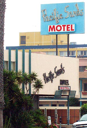 Nope. While researching the The Pacific Sands Motel, 1515 Ocean Avenue, I ran across a slew of bad comments at tripadvisor.com: "Disgusting beyond imagination", "I never saw a dirty motel like that", "I have visited Hellville", "Like living in the Projects", "I wished for the first time in my life that I had a handgun license" and "a miserable den for who knows what illicit activity".
Back up in Palisades Park is Santa Monica's Camera Obscura at 1450 Ocean Avenue. I didn't get to go inside, but you can see interior pictures here, and an in-depth history of the device, here.
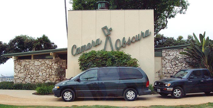 "Camera obscura" is Latin for "dark chamber", and that's precisely what this is - a dark room in which an image is projected via lenses and mirrors from a rotating turret above. The concept, with a very few refinements along the way, stretches back over 2300 years to designs by Aristotle and others. The mechanism in this particular one dates back to 1899 when it was a very popular sideshow attraction. Sadly, it is largely neglected and under-promoted.
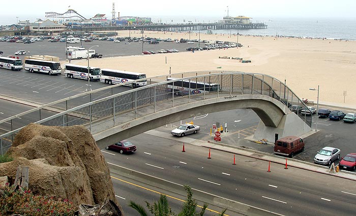
A pedestrian bridge spans Highway 1 from Palisades park over to the beach. Highway 1 is also called the Pacific Coast Highway. You can see Santa Monica Pier in the distance. Shall we walk over to the beach?
Looking back from below, I was struck by the eroded rock formations at the top of the 100-foot bluff that Ocean Avenue and Palisades Park are perched upon.
Those towers look like....well, never mind.
On the beach, just north of the pier, is "Walk on LA", a 1988 "art tool" designed by Carl Cheng. When pulled by a tractor, it leaves the imprint of a city in the sand.
 The project was commissioned by the City of Santa Monica Percent for Art program with funds from the National Endowment for the Arts and the Santa Monica Arts Foundation. There's a good listing of public art in Santa Monica at santamonica.com.
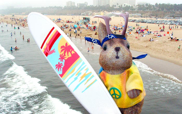
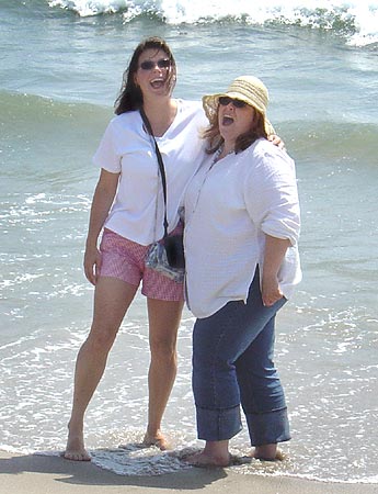
Ace meets a new entourage in LA. The two new female drivers decide to set foot in the Pacific...
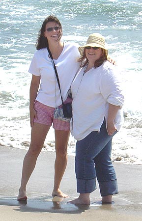
...and discover the water is cold today.
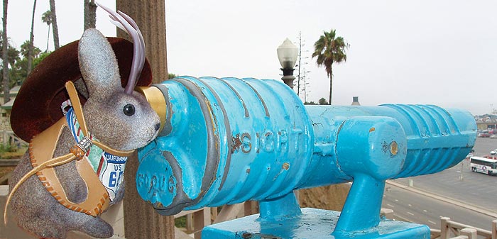
So, I'm in the park, minding my own business and doing nothing that should attract attention - just watching a jackalope check out an observation telescope, and I hear "Oh!...is so cute!"
 The scent of perfume wafts into my personal space. I turn around and see a young woman dressed to the nines and made up for a photo shoot.
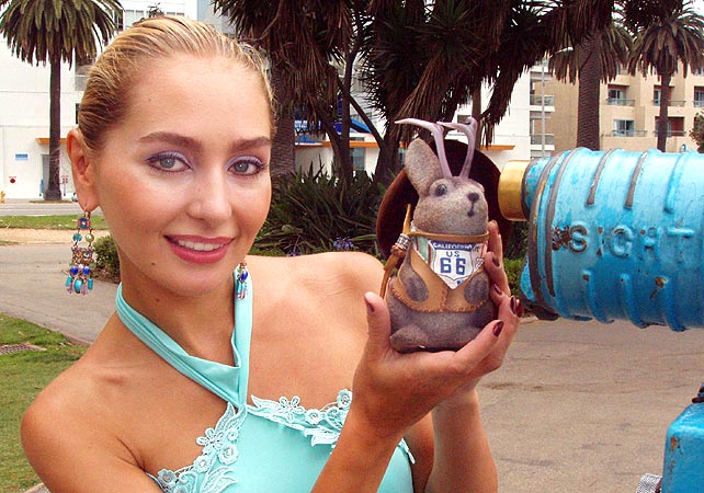 Her photographer and, I assume, agent, helps translate for her since she's from...well, I forget where she's from, but it was an ex-soviet country.
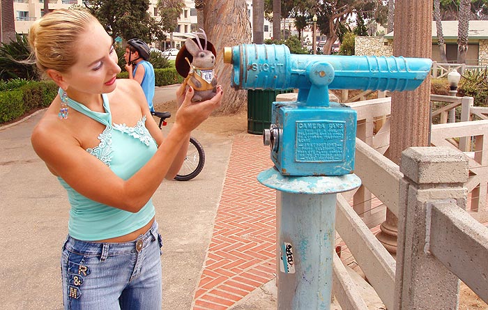 Anyway, they ask if I'm publishing my pictures and I tell them about this blog. They don't know what a "blog" or a "weblog" is, but she brightens at the term "internet" and she wants to hold Ace - many women do for some reason - and he never says no.
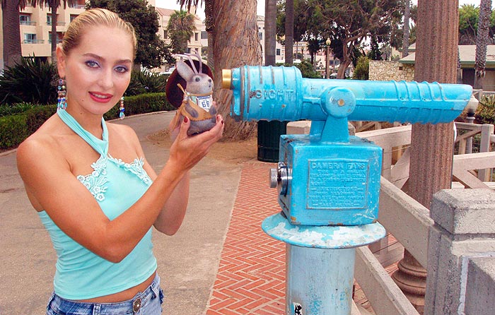 Such is the life of a cultural investigator.
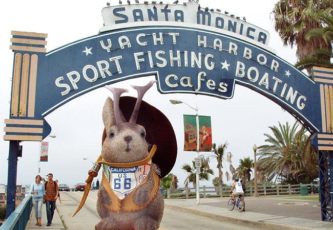
Journeys often start and finish with a passage through a ceremonial arch. Ace Jackalope poses for the classic "end of Route 66" photo at the entrance to the Santa Monica Pier, the spiritual end to our Route 66 journey. The entry arch was built in 1938 by the federal Works Project Administration.
 It was August 6, seven days after we drove under another arch near the beginning of our road trip on July 30, below.
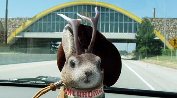
Yes, ceremonial arches...Tolkien's Moria, Paris' Arc de Triumph...in our case, the McDonald's in Vinita Oklahoma and the arch at Santa Monica Pier.
There is a steep ramp down to the pier. I believe the ramp is also a WPA project and dates from 1938.
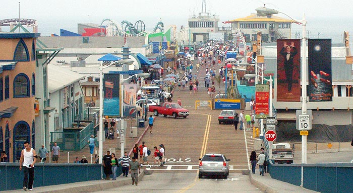
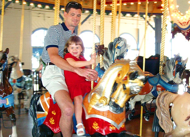
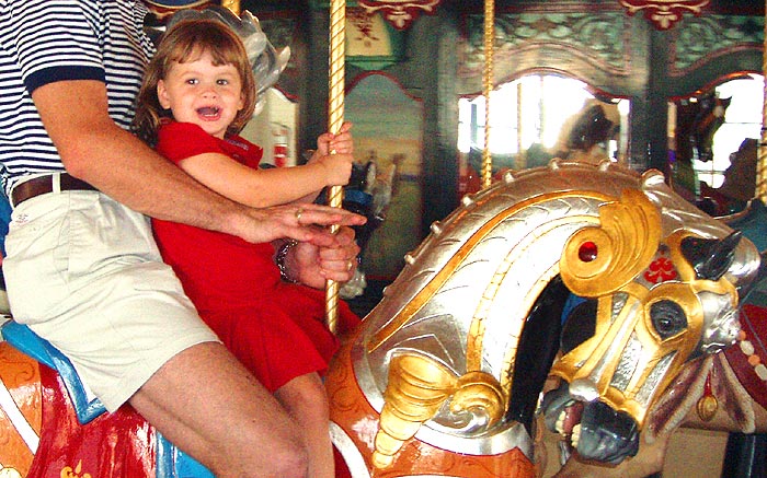
One of the first attractions you'll see is, in our opinion, the best. It's the only one that has much history attached to it.
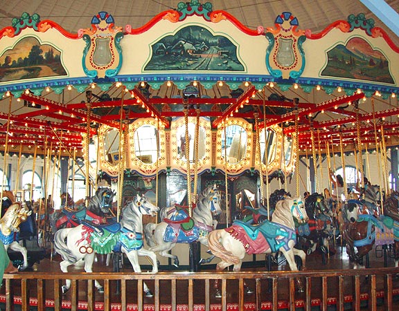 This carousel replaced an earlier one and was built by the Philadelphia Toboggan Company in 1922. It resided in a few places before coming to rest here in 1947; it was restored in 1990 and has appeared in numerous TV shows and movies, including "The Sting."
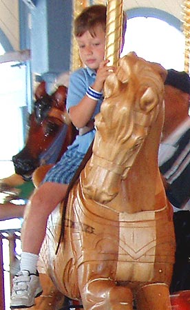
Even unpainted, there is an appeal about these things.
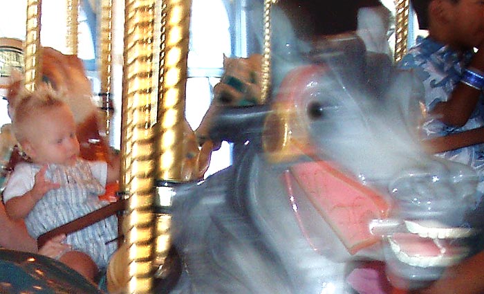
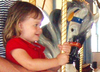
A little motion blur gives the unsettling visage of a baby being pulled by a spectral horse.
And if you ever wonder at the wisdom of maintaining such things, just read the expressions.
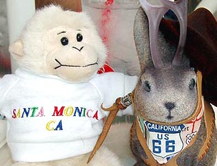
Ace meets a new friend, "Da Munkee" in the carousel giftshop.
As I was editing this photo of this cool, kinda retro-looking Santa Monica Police station on the pier, I ran across this note in Route 66 News about surveillance cameras being installed on the pier: "Some men were videotaping in a manner that was inconsistent with tourist photography. They were photographing access roads and security structures" said the Chief of the Santa Monica Police Department.
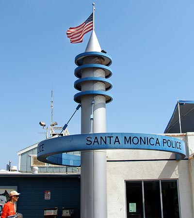
I wonder if they realize that some movements around the pier can be monitored by a 24 hr webcam?
Now that's what I call art. I'm serious; I love the giant Testors bottle.
The pier has the usual tourist trappy features.
Kids play with remote-controlled boats.
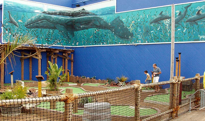
There's a pirate themed nine-hole miniature golf course which can be played for $5. The mural at top advertises an aquarium under the pier at the east end.
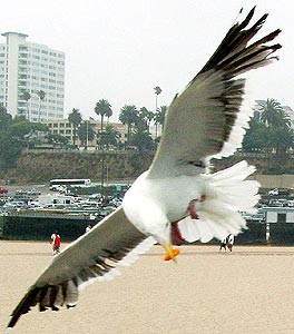
It must be cool to be a seagull at a tourist trap...
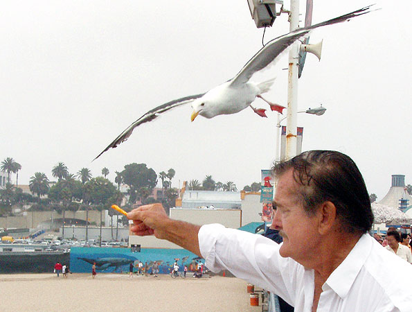 ...there's always someone wanting to feed you the cheese that goes crunch.
The harbor office sits beside an old observation building which currently houses Mariasol, a Mexican restaurant where we had lunch.
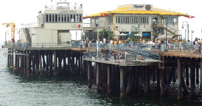 The observation building is a Santa Monica landmark and Mariasol got into a bit of controversy with the city government a few years ago when they made unauthorized changes to the upper part of the building, which is supposed to be an open viewing deck. The restaurant installed some windows which did not open, but managed to get approval after they had done so, provided they make a few changes.
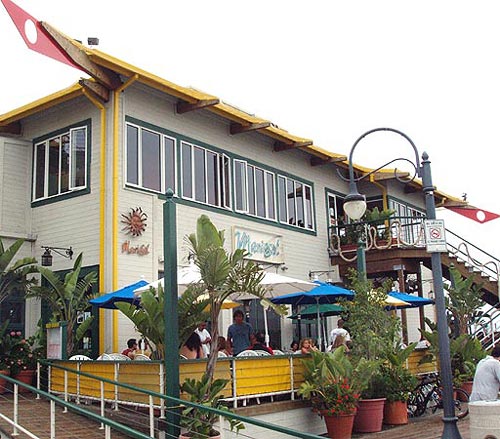
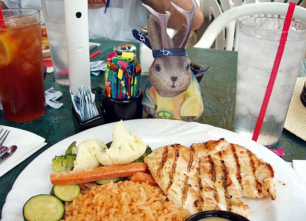
Mariasol's food was good, but they charge for drink refills.
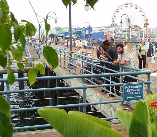
 This was our view from downstairs. The pier is a popular place to fish.
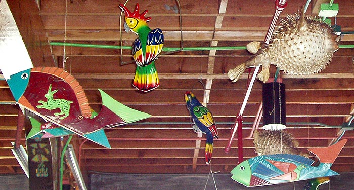
Mariasol's decor uses one of my favorite tiki bar decorations, the puffer fish...too bad this isn't a tiki-theme location; that'd rock, especially on a pier.
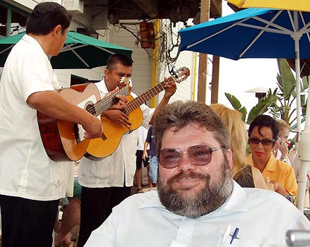
Soon, Ace would be saying goodbye to two of his drivers as they had to return to the Midwest. This one was made slightly uncomfortable by the musicians.
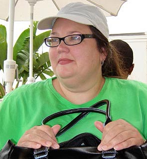
The other departing driver holds her purse at the ready, a signal she is done with this place and ready to seek other touristic venues.
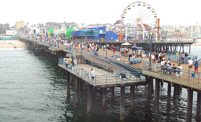
A view from the Pacific end shows the original pier stretching back to the shore, and the connected "amusement pier" at right, which is currently home to Pacific Park, an amusement park of recent vintage. Previous to this amusement park, there had been another one called Pacific Ocean Park which operated from 1958 to 1967 and was demolished in 1974.
This young tourist has found the facility to her liking.
I'm just glad I never take pictures "inconsistent with tourist photography."
 It would look as if Da Munkee, who is nowhere to be seen, has given Ace the shirt off his back.
Ace and I would like to thank the people that aided us in August's Route 66 journey and our subsequent exploration of LA: Barb, Mark, Mia, Natalie, Patsy, Richard and William - seven very patient fellow explorers. And, thanks to Mark for the second plaque picture and to Richard for the two pictures of the girls in the surf.
After finishing Route 66, we explored quite a few of LA's mid 20th century architectural treasures, we basked in googie and we swam in tiki. Ace even hopped a cruise ship to Mexico, but that is another story.
For our entire 2005 Rt66/I-40 trip, see:
Joplin to Amarillo
Amarillo to Holbrook
Holbrook to Winslow
La Posada
Grand Canyon
Seligman
western AZ
From the California border onward, we stayed to Route 66:
Colorado River crossing
Needles
Needles to Fenner
Fenner to Amboy
Amboy
Amboy to Barstow
Barstow
Barstow to Victorville
Victorville - California Route 66 Museum
Victorville to Rialto
Rialto Wigwam Motel
Outer Los Angeles
Los Angeles
Santa Monica Pier
Other posts concerning California:
The Future was so Cool in 1961
Goodbye, Sam's Seafood
It was August 6 and we reached the end of our Route 66 journey; we returned with a different entourage on August 11.And where, exactly, does Route 66 end?
I've always seen Santa Monica Pier or Pallisades Park listed as the end, but, technically, the consensus seems to be that it ends at Lincoln and Olympic Boulevards, a few blocks inland. I was chatting about this with a friend at a restaurant, when serendipity dropped the answer in my lap. A lone gentleman on the booth behind me apologetically interjected that he's been listening and that he had lived for many years in Santa Monica, about which he spoke wistfully. I asked him, "where, technically, does Route 66 end?""At the park" he answered definitively, as if it had been silly for me to ask such an obvious question.
So, there ya go. Tradition and affectionate regard win over technicality in my book, so, as far as Ace and I are concerned, Route 66 ends with Palisades Park and the Santa Monica Pier. Funny how we say it "ends" here rather than "begins" here; most of the guidebooks and websites treat Rt66 as an east-to-west journey. Maybe its an echo of the old dustbowl migration days.At the Northern end of Palisades Park you'll find this plaque.
It bears the inscription: "Will Rogers Highway; Dedicated 1952 to Will Rogers; Humorist; World Traveler; Good Neighbor; This Main Street of America, Highway 66, was the first road he traveled in a career that led him straight to the hearts of his countrymen"By the way, lest you think the pithy humor of Will Rogers outdated, I'd like to offer the following quotes:
"We always want the best man to win an election. Unfortunately, he never runs."
"A fool and his money are soon elected."
"If we ever pass out as a great nation we ought to put on our tombstone 'America died from a delusion that she had moral leadership'"
But, back to Route 66 and the plaque. It was placed here by Warner Brothers, Ford and the Main Street of America Association, not only to honor Rogers but as part of a publicity campaign for the 1952 movie The Story of Will Rogers. Not that we have any misgivings about adopting it as the our own personal end of Rt 66, but isn't it fitting that a city so associated with make-believe would have a plaque marking the end of a road where it isn't but where we would like to to be?
Palisades Park is beautifully landscaped with palm, oak, and eucalyptus trees lining paved and natural paths that run past gardens with exotic and native plants. It is also inhabited by homeless people. One of the days I was there, the homeless out-numbered the tourists; Michael Wallis wrote about a soup kitchen here in his book "Route 66, The Mother Road."When I shot the picture below, I was thinking "what a cool looking place; maybe we should have stayed there instead of the Motel 6 in Hollywood."
Nope. While researching the The Pacific Sands Motel, 1515 Ocean Avenue, I ran across a slew of bad comments at tripadvisor.com: "Disgusting beyond imagination", "I never saw a dirty motel like that", "I have visited Hellville", "Like living in the Projects", "I wished for the first time in my life that I had a handgun license" and "a miserable den for who knows what illicit activity".Back up in Palisades Park is Santa Monica's Camera Obscura at 1450 Ocean Avenue. I didn't get to go inside, but you can see interior pictures here, and an in-depth history of the device, here.
"Camera obscura" is Latin for "dark chamber", and that's precisely what this is - a dark room in which an image is projected via lenses and mirrors from a rotating turret above. The concept, with a very few refinements along the way, stretches back over 2300 years to designs by Aristotle and others. The mechanism in this particular one dates back to 1899 when it was a very popular sideshow attraction. Sadly, it is largely neglected and under-promoted.A pedestrian bridge spans Highway 1 from Palisades park over to the beach. Highway 1 is also called the Pacific Coast Highway. You can see Santa Monica Pier in the distance. Shall we walk over to the beach?
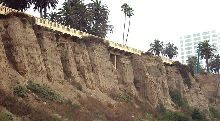
Looking back from below, I was struck by the eroded rock formations at the top of the 100-foot bluff that Ocean Avenue and Palisades Park are perched upon.
Those towers look like....well, never mind.
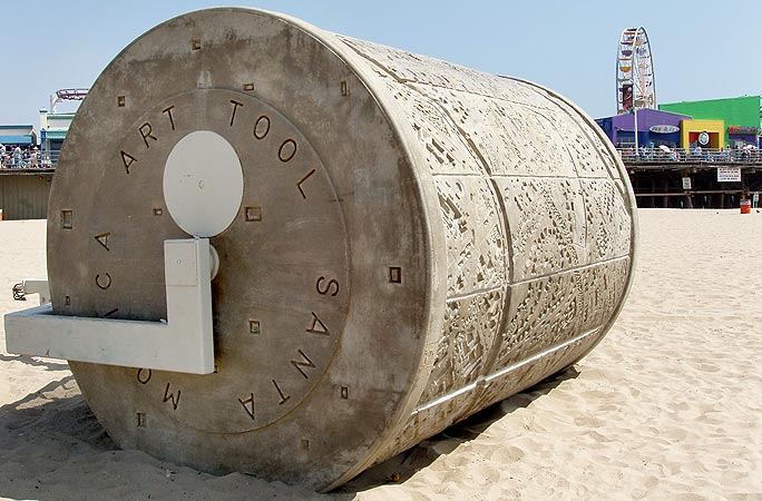
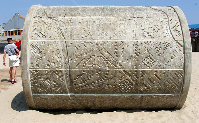
On the beach, just north of the pier, is "Walk on LA", a 1988 "art tool" designed by Carl Cheng. When pulled by a tractor, it leaves the imprint of a city in the sand.
The project was commissioned by the City of Santa Monica Percent for Art program with funds from the National Endowment for the Arts and the Santa Monica Arts Foundation. There's a good listing of public art in Santa Monica at santamonica.com.Ace meets a new entourage in LA. The two new female drivers decide to set foot in the Pacific...
...and discover the water is cold today.
So, I'm in the park, minding my own business and doing nothing that should attract attention - just watching a jackalope check out an observation telescope, and I hear "Oh!...is so cute!"
The scent of perfume wafts into my personal space. I turn around and see a young woman dressed to the nines and made up for a photo shoot. Her photographer and, I assume, agent, helps translate for her since she's from...well, I forget where she's from, but it was an ex-soviet country. Anyway, they ask if I'm publishing my pictures and I tell them about this blog. They don't know what a "blog" or a "weblog" is, but she brightens at the term "internet" and she wants to hold Ace - many women do for some reason - and he never says no. Such is the life of a cultural investigator.Journeys often start and finish with a passage through a ceremonial arch. Ace Jackalope poses for the classic "end of Route 66" photo at the entrance to the Santa Monica Pier, the spiritual end to our Route 66 journey. The entry arch was built in 1938 by the federal Works Project Administration.
It was August 6, seven days after we drove under another arch near the beginning of our road trip on July 30, below. Yes, ceremonial arches...Tolkien's Moria, Paris' Arc de Triumph...in our case, the McDonald's in Vinita Oklahoma and the arch at Santa Monica Pier.
There is a steep ramp down to the pier. I believe the ramp is also a WPA project and dates from 1938.
One of the first attractions you'll see is, in our opinion, the best. It's the only one that has much history attached to it.
This carousel replaced an earlier one and was built by the Philadelphia Toboggan Company in 1922. It resided in a few places before coming to rest here in 1947; it was restored in 1990 and has appeared in numerous TV shows and movies, including "The Sting."Even unpainted, there is an appeal about these things.
A little motion blur gives the unsettling visage of a baby being pulled by a spectral horse.
And if you ever wonder at the wisdom of maintaining such things, just read the expressions.
Ace meets a new friend, "Da Munkee" in the carousel giftshop.
As I was editing this photo of this cool, kinda retro-looking Santa Monica Police station on the pier, I ran across this note in Route 66 News about surveillance cameras being installed on the pier: "Some men were videotaping in a manner that was inconsistent with tourist photography. They were photographing access roads and security structures" said the Chief of the Santa Monica Police Department.
I wonder if they realize that some movements around the pier can be monitored by a 24 hr webcam?
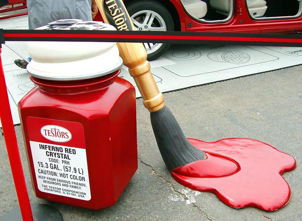
Now that's what I call art. I'm serious; I love the giant Testors bottle.
The pier has the usual tourist trappy features.
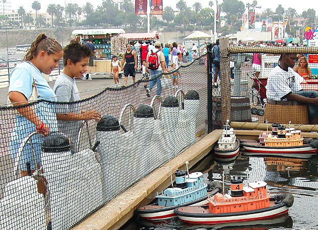
Kids play with remote-controlled boats.
There's a pirate themed nine-hole miniature golf course which can be played for $5. The mural at top advertises an aquarium under the pier at the east end.
It must be cool to be a seagull at a tourist trap...
...there's always someone wanting to feed you the cheese that goes crunch.The harbor office sits beside an old observation building which currently houses Mariasol, a Mexican restaurant where we had lunch.
The observation building is a Santa Monica landmark and Mariasol got into a bit of controversy with the city government a few years ago when they made unauthorized changes to the upper part of the building, which is supposed to be an open viewing deck. The restaurant installed some windows which did not open, but managed to get approval after they had done so, provided they make a few changes.Mariasol's food was good, but they charge for drink refills.
This was our view from downstairs. The pier is a popular place to fish.Mariasol's decor uses one of my favorite tiki bar decorations, the puffer fish...too bad this isn't a tiki-theme location; that'd rock, especially on a pier.
Soon, Ace would be saying goodbye to two of his drivers as they had to return to the Midwest. This one was made slightly uncomfortable by the musicians.
The other departing driver holds her purse at the ready, a signal she is done with this place and ready to seek other touristic venues.
A view from the Pacific end shows the original pier stretching back to the shore, and the connected "amusement pier" at right, which is currently home to Pacific Park, an amusement park of recent vintage. Previous to this amusement park, there had been another one called Pacific Ocean Park which operated from 1958 to 1967 and was demolished in 1974.
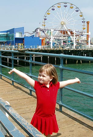
This young tourist has found the facility to her liking.
I'm just glad I never take pictures "inconsistent with tourist photography."
It would look as if Da Munkee, who is nowhere to be seen, has given Ace the shirt off his back.Ace and I would like to thank the people that aided us in August's Route 66 journey and our subsequent exploration of LA: Barb, Mark, Mia, Natalie, Patsy, Richard and William - seven very patient fellow explorers. And, thanks to Mark for the second plaque picture and to Richard for the two pictures of the girls in the surf.
After finishing Route 66, we explored quite a few of LA's mid 20th century architectural treasures, we basked in googie and we swam in tiki. Ace even hopped a cruise ship to Mexico, but that is another story.
For our entire 2005 Rt66/I-40 trip, see:
Joplin to Amarillo
Amarillo to Holbrook
Holbrook to Winslow
La Posada
Grand Canyon
Seligman
western AZ
From the California border onward, we stayed to Route 66:
Colorado River crossing
Needles
Needles to Fenner
Fenner to Amboy
Amboy
Amboy to Barstow
Barstow
Barstow to Victorville
Victorville - California Route 66 Museum
Victorville to Rialto
Rialto Wigwam Motel
Outer Los Angeles
Los Angeles
Santa Monica Pier
Other posts concerning California:
The Future was so Cool in 1961
Goodbye, Sam's Seafood
posted by Ace Jackalope at 3:55 AM
![]()
![]()

1 Comments:
hi, by chance i happend to come across your blog, this summer i went to santa monica and some other places along the cost of california, i've loved route 66 for so long, i didn't know it ended there in the park, i didn't even see the sign in fact, which makes me kinda regret it.. but thanks anyways for sharing your trip with everyone ;)
cheers,
fran
Post a Comment
<< Home