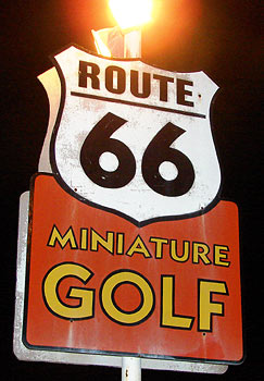
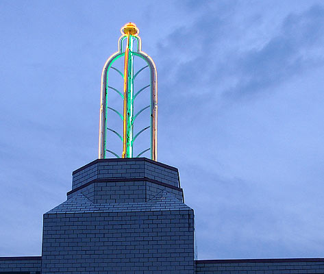
While in Clinton, Oklahoma for the 2007 Route 66 Festival, I had the luck to run across a miniature golf course near my motel.
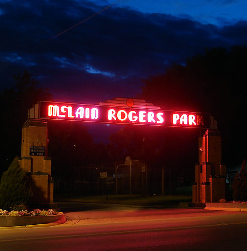
Route 66 Miniature Golf, 832 S 10th St, is part of McLain Rogers Park on one of Clinton's Route 66 alignments.
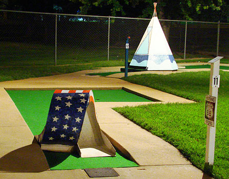
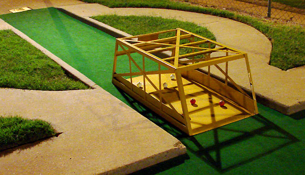
The course contains three classic older metal miniature golf obstacles; of which this loop is the most common. Over the last few years I've asked many a mini-golf course owner where these things came from and a company called "Wittig" is the most common answer. I've never found much information on the company and welcome reader input on this. Like neon signs and soda fountains, miniature golf obstacles (those that were manufactured as such instead of being owner-built) aren't so common anymore. Aside from the decline in popularity of miniature golf courses in general, many businesses that remained disposed of their obstacles during the 1980s trend toward courses that emphasized landscaping and sought respectability as "evolved."
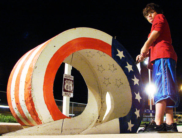
Jonathon Johnston from Norman, OK watches the trajectory of his golf ball. Note the Rt66 sign visible through the loop.
The metal bridge is the second of the classic metal obstacles. I've photographed a few of them over the years and they are identical, so I assume there was a common manufacturer.
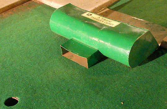
This diabolical "ball return trap" is the third of the three classic metal obstacles. While there are many metal Eiffel Towers, windmills and such out there, they lack the manufactured consistency of the previous three obstacles. Courses also used fiberglass obstacles, but they tended to also be marketed as company attention-getters and not exclusively mini-golf ornaments.
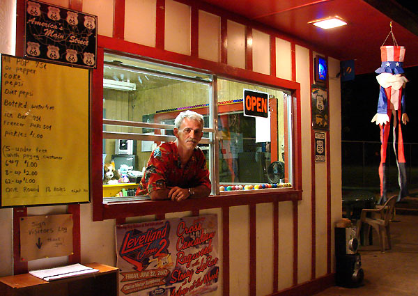
Rollie Smith (pictured) and his son, Sidney, run the course, which Sidney began leasing from the city of Clinton about a year ago. Smith says they've made many improvements and hope to continue to tweak the course over term of the lease, which is ten years with an option for another ten.
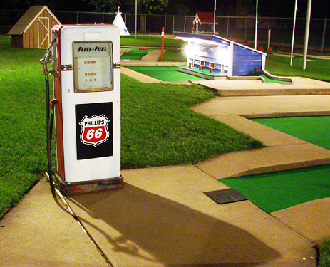
A Phillips 66 Flite Fuel pump adds to the ambiance. I've got to say it's one of the cleanest courses I've seen.
How fitting this was for the first day of the season. Nothing quite says summer like the buzz of fluorescent lights overhead, occasionally punctuated by the hollow plop of a "not quite a real golf ball" into the cup. Yeah, life is good.
If you revel in the kitsch of miniature golf, I highly recommend the book Miniature Golf, by writers Nina Garfinkel, Maria Reidelbach and photographer John Margolies. It has the coolest book cover I've ever seen; it's made of AstroTurf.
Rolla, MO - Stonehenge and Hillbillies on Route 66
Happy Midsummer's Day! We're not at Stonehenge - no, far from it.
We travelled through Rolla, MO twice this year on weekend Route 66 jaunts: April 7th and 8th, and June 2nd and 3rd. This is a patch of 66 just SW of Rolla. All of the sights in this post - and it's a long one so I apologize to dial-up users - are along Route 66 unless noted otherwise.
If half the fun is getting there, then at least 1/10 of it is billboard-induced anticipation, at least for me.
The main impetus for the April trip was the then-imminent name change of the Totem Pole Trading post due to a reported sale.
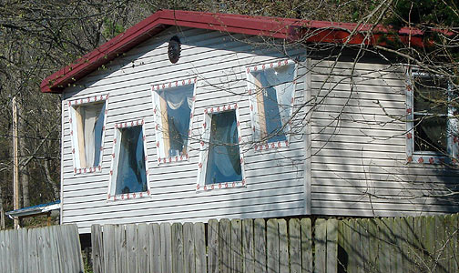
I shot pictures of practically everything of even minor interest to me, like the odd windows in this structure.
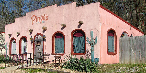
The building that houses Pinga's Tortilla Flats at 14775 County Road 7100 (Route 66), may have an interesting history. The sign on Pinga's door read "Closed if'n we're gone."
Ahh...another trading post billboard. I'll admit to being a tourist trap junkie. The inner ten-year-old in me always wants to stop, and the adult caves in and lets him.
Besides, maybe I need a sword or a life-size animal.
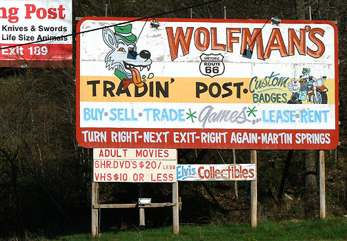
But I wasn't expecting quite this kind of a trading post.
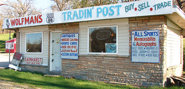
Wolfman's Trading Post, 13700 Martin Spring Outer Road, sells all sorts of sports collectibles.
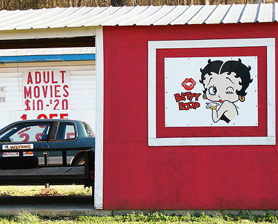
And they have porn too! I always wondered what Betty Boop really did for a living. I'd better not let the inner ten-year-old see this.
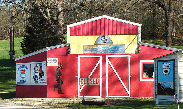
There appears to be a small Route 66 mural back by the flea market part of the business.
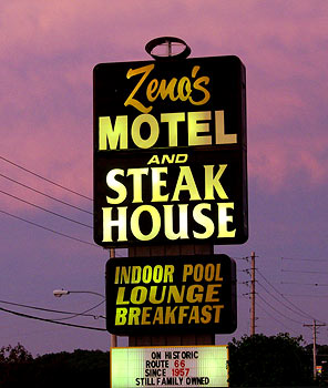
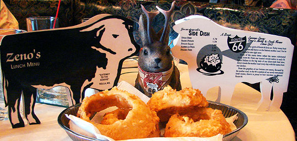
Zeno's
Our motel for June 2 was Zeno's, 1621 Martin Springs Drive.
I chose Zeno's because it is independently owned and had history. The front part of Zeno's is 50 years old; it was built in 1957.
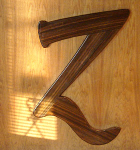
This wood "Z" is on front of the lobby desk.
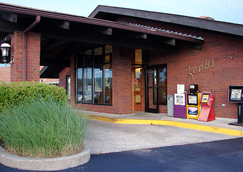
The lobby
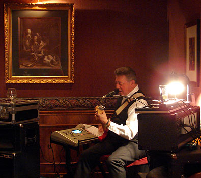
Musician Dennis Foster was playing as I peeked into Zeno's Lounge from the lobby. A few of the locals who came in to dinner seemed to be pleased by this.
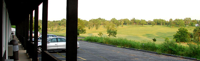
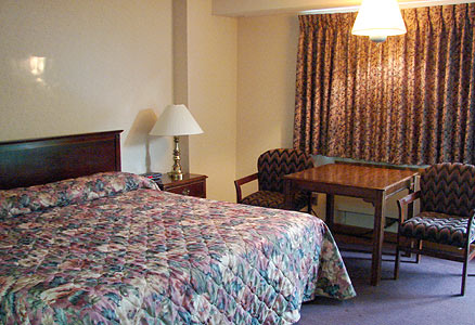
Our room in the back building, added in 1973, overlooked a pastoral valley.
I imagine this would be a wonderful place to listen to cicadas, but we were too early in the year for that.
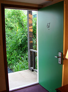
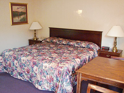
I've taken to photographing motel rooms if I can remember to do so before I've dumped my travel crap all over them (which takes about 30 sec). This place was neat and clean, by the way, and cost $52 with my AAA discount for two people.
Photographing motel rooms may be the most useful thing I do for fellow travelers. I know I'd certainly like to have photos of rooms that were shot by customers and not ad people before I make a reservation.
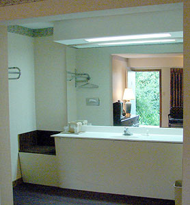
There was an odd little sort of seat at the end of the bathroom counter. I used it to set up the laptop so it wouldn't disturb my lovely significant other as she slept.
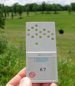
The rooms, at least the ones in our building, used these Ving card keys. (I altered the dot pattern in Photoshop so this one could not be forged.)
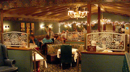
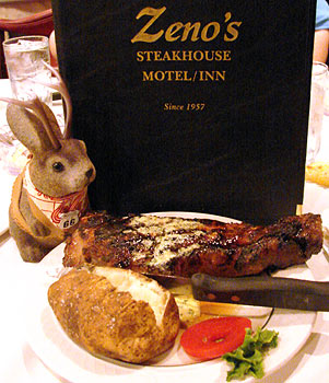
Zeno's Steak House, added to the building in 1959, is a slightly pricey but restful place to eat after a day on the road. It'd be a good date restaurant.
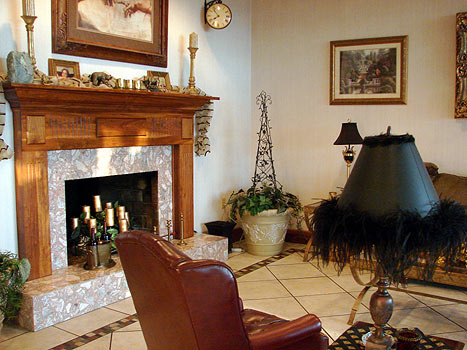
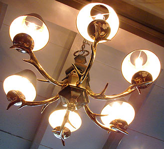
This is one of the chandeliers.
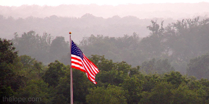
After we gave our dinner orders, I went outside to catch an Ozark scene - a flag against a misty evening backdrop, right at sunset.
The 20 oz Zeno's Pride steak at $24.95 was fine - not the meaty ambrosia of Oklahoma City's Cattleman's Cafe, but about on par with The Big Texan. Yeah, we like steak.
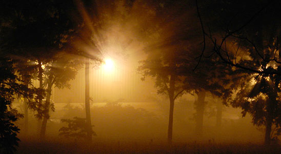
Mist gathered in the valley below the room.
We had lunch there the next day. The onion rings had been recommended to us, so we ordered some. They were huge and delicious. Notice that the die cut lunch menu resembles those of Rod's Steakhouse in Williams, AZ.
Co-owner Tracey L. Scheffer was working the register; she was happy to answer our history questions and give us souvenir menus.
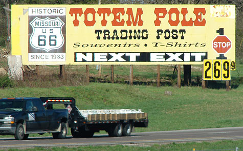
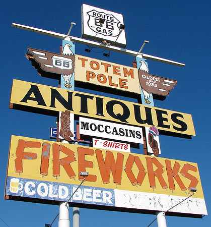
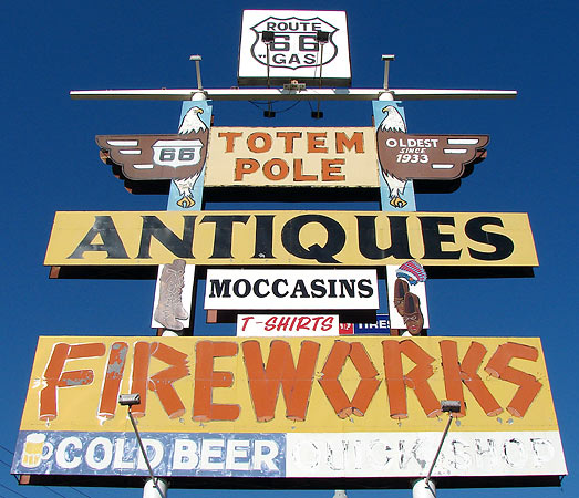
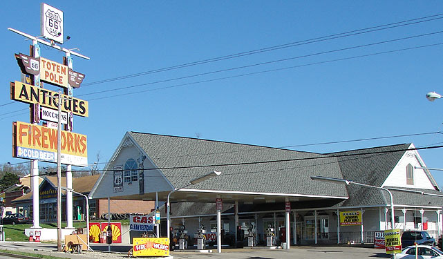
Totem Pole Trading Post
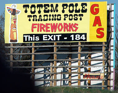
The Totem Pole Trading Post was our main goal in Rolla. I'd read in the tourist-essential Route 66 News, and the online Rolla Daily News that it had been sold, and the name would change. I wanted to get photos of the sign before the name change occurred.
In case you're not familiar with travel in Missouri, let me inform you that fireworks are a hot sales item here, especially along the interstates. I believe some of the neighboring states are not as liberal as MO in this matter, hence the booming sales.
The Totem Pole Trading Post, 1413 Martin Springs Drive has been in business since 1933. I've read that it has been moved a few times to accommodate changes in the road, but an employee told me the west (right) part of the building - which now houses a small convenience store - is the oldest part of this particular structure.
There's a bit of gas station nostalgia outside.
Inside, a hillbilly theme prevails in the gift shop.
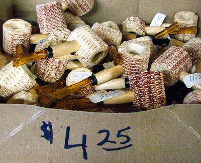
Corn cob pipes are as standard in this area as are Indian-theme key chains out in Arizona and New Mexico.
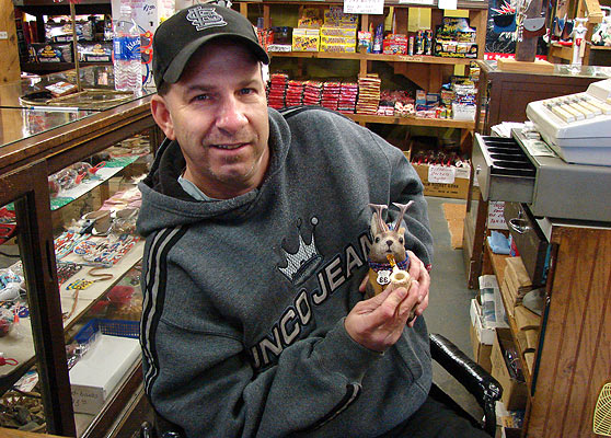
Dean Evans was working the counter that day and showed Ace Jackalope how to smoke a corn cob pipe. He informed me that the sale of the business had fallen through, but I was happy I'd had a catalyst to get me up to Rolla anyway.
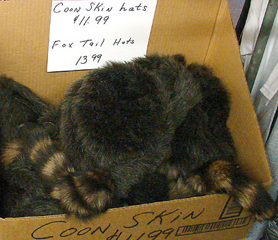
A coon skin cap would go nicely with a Red Ryder B-B gun, wouldn't it?
There's also a slightly adult element to the gift shop selection in that they have older Playboy magazines and some joke novelty figurines that are in a...uh...a state of turgidity.
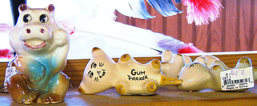
There were more mainstream items also, like this "gum parker." This is the sort of thing I'd see in a grandmother's house, circa 1970.
There's a flea market section, too.
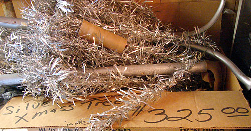
But it's not a bargain basement. $325 is a lot to pay for an aluminum Christmas tree.
I didn't see a price on these juke boxes.
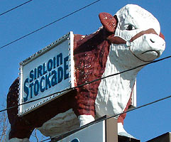
Moving on toward central Rolla, we encountered Sirloin Stockade, 1401 Martin Springs Drive. It's a chain restaurant, and therefore usually would not register on my touristic radar, but I include the sign here because big fiberglass cows are one of those once-ubiquitous things that seem to be thinning out. I imagine many sign ordinances frown on fiberglass bovines.
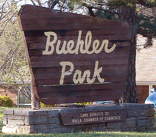
After a little interchange involving I-44, Route 66 changes from Martin Springs Road to Kings Highway, or King's Highway or Kingshighway, depending on where you look. Buehler Park is on the north side of Kings Highway; I always like to see googie-esque park signs.
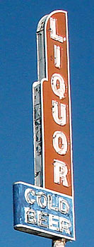
I didn't get the name of this liquor store on the south side of Kings Highway, but a reader has commented that it is called Beverage Mart. The sign does light up at night, but I wasn't able to stop and shoot it.
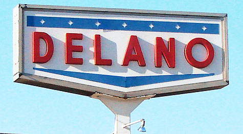
The main route of Route 66 turns north off Kings Highway onto Bishop Avenue (US 63). I'd never seen a Delano gas station, so I shot the sign.
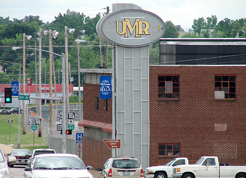
I presume this rather stylish building at 11th St and North Bishop Avenue is part of the University of Missouri - Rolla. "UMR" is the common abbreviation of this branch of the Missouri University system.
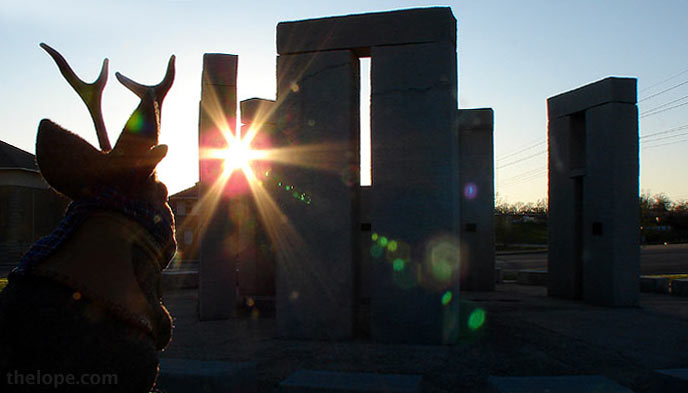
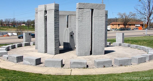
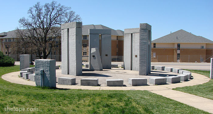
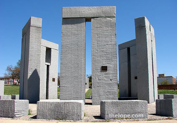
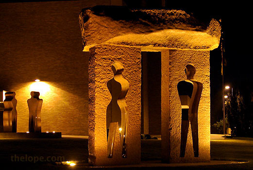
UMR Stonehenge
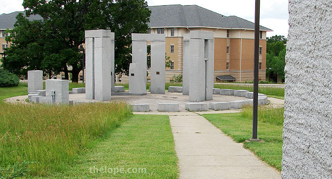
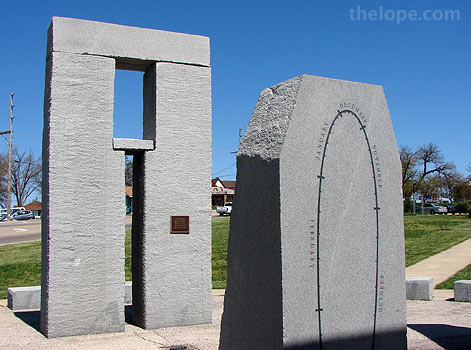
UMRStonehenge, (I've also heard it called "stubby Stonehenge") is a partial replica of the British megalithic monument.
It was erected in 1984 on the northwest edge of the campus at 14th Street and Bishop Avenue, where Route 66 curves toward the northeast. The diameter, to the outer ring of stones, is 50 feet.
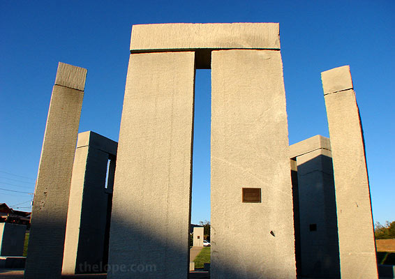
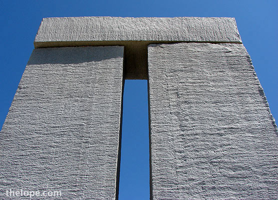
The five trilithons, are 13 1/4 feet high. "Trilithon" refers to the arrangement of two upright stones with a lintal across the top of both.
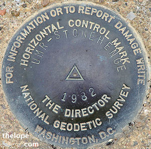
Like the original Stonehenge, this one is capable of astronomical alignments. Most of these are seen while standing on this marker in the center of the monument, while looking through the slits created by the vertical stones in the trilithons.
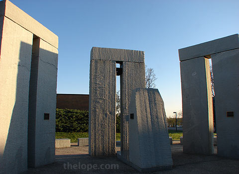
The only problem with UMR Stonehenge is that hilly, built-up Rolla isn't exactly Salisbury Plane. In fact, I do believe that all of the solstice and equinox sunrises and sunsets are blocked by landscape and buildings. For example, this angle from beside a marker stone shows the view toward the Midsummer sunrise - blocked by a rather large building.
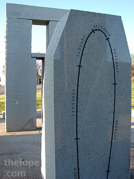
However, Rolla's Stonehenge does a neat little trick that the original doesn't do, and it does it with a small obelisk called an analemma. The analemma is a sort of calender; a spot of noon sunlight falling through a space at the top of the slit in the south-facing trilithon (center of photo) falls on a slightly different spot on the analemma every day.
Over the span of a year, this dot-to-dot pattern traces a figure-8 on the upright stone and horizontal base of the analemma.
The gap at the top of the trilithon at left is a Polaris window, through which Polaris (the north star) can be seen while standing on a marked place on the monument floor.
While it doesn't instill the awe of the original, UMR Stonehenge does have a certain magesty and I wish my town had one.
The rock was cut with the university's Waterjet equipment, which used two waterjets cutting at a pressure of 15,000 pounds per square inch traversing the surface like a conventional saw. The cutter moved at about 10 feet per minute and cut between one-quarter and one-half inch on each path.
The same technology was used to cut the nearby Millennium Arch, designed by artist Edwina Sandys. It's not on Route 66, but is nearby on 10th street.
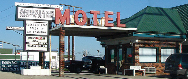
Moving on around Bishop Avenue, we saw the American Motor Inn motel, included here because of the sign.
"city" 66 Before we move northeast on out of Rolla, we shouldn't forget that there was a "city" route.
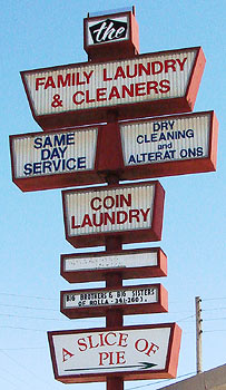
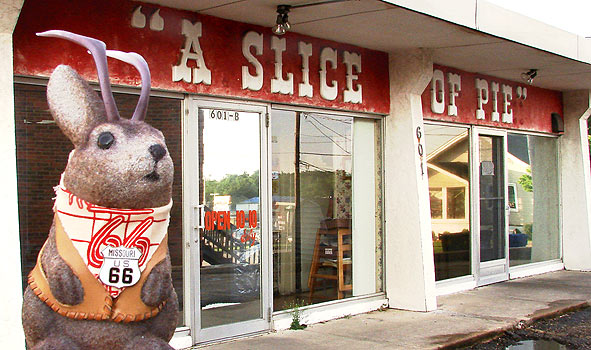
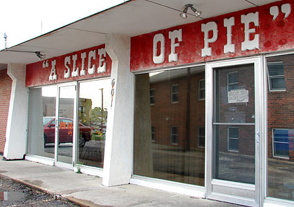
Had we stayed on Kings Highway instead of turning north onto Bishop Avenue, we'd have come across the small strip mall that contains A Slice of Pie at 601 Kingshighway Street.
The first time we found it, on March 8, it was closed for Easter - hence, the terrible fate of having no pie.
We'd since read about the place in Route 66 News and were sorry we'd missed it, so we were delighted to come back when they were open.
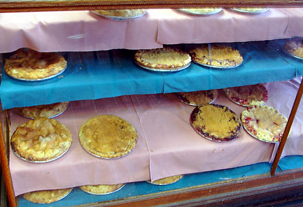
Inside, pies in old wooden cases held the promise of tasty break from the road. The last time I'd had a good slice of pie was back in April at the MCC sale.
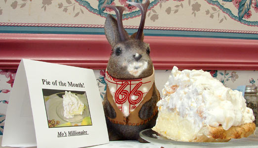
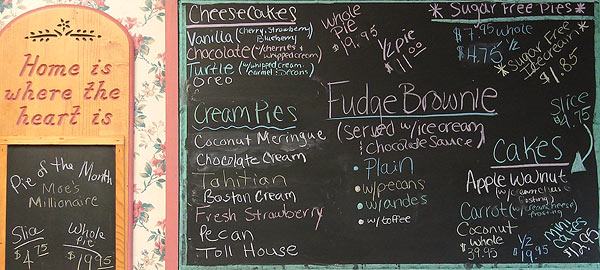
The pie of the month - and my first choice - was Moe's Millionaire. You can never turn your back on a jackalope when pie is in the room, by the way.
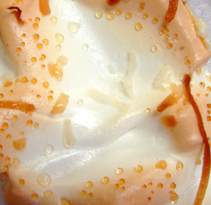
Travel has made me appreciate the diversity of pie. I think the first time I realized this was at the Midpoint Cafe in Adrian, TX. I admired the top of this slice of as one might study the surface of a delicious planet.
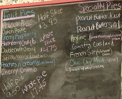
I've heard from a few readers that like pie, so I'm including a couple menu shots.
Route 66 merges into 6th Street, and then turns north onto Pine Street, which is currently one-way over most of its run. I do not know if this was the case back when it was Route 66.
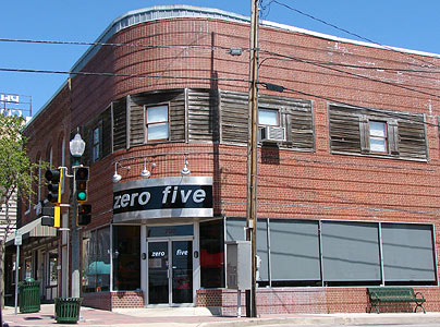
A coffee shop called "Zero Five" recently inhabited a cool rounded building at 700 N Pine Street.
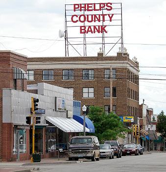
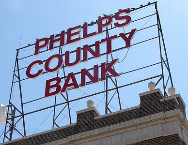
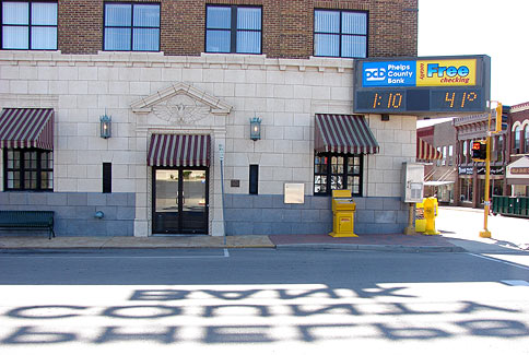
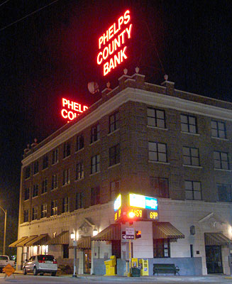
Phelp's County Bank, 718 N Pine, with its two rooftop signs, dominates the downtown stretch of Route 66.
According to the bank's Vice President and local history buff, Jim Marcellus, the building was built as the Edwin Long Hotel in March of 1931 and always had a bank in the first floor. The two signs originally read "HOTEL." The building housed a succession of banks, becoming the Phelps County Bank in 1963; the hotel closed in 1971. The building is on the National Historic Register.
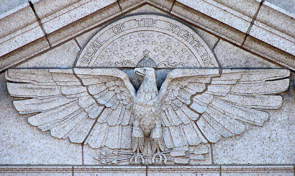
Marcellus said the hotel's construction was rushed to coincide with the official opening of Route 66 in Missouri, for which the hotel was committee headquarters, and that 8,000 people, including the governor, crowded into the intersection around 8th and Pine for the ceremony. He also mentioned that a 72,000 gallon cistern lies under the intersection and was used by the fire department in by-gone years. It was only recently filled with stone.
I thought at first that the carved eagle concealed a previous state seal, but Marcellus tells me he does not believe the carvings were ever altered.
Of course, no matter how tired one is, one must go out late at night to shoot signs. The two signs face the directions of approach from Route 66, circa 1931, before Pine was one-way.
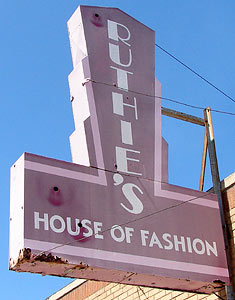
Just off of Pine is Ruthie's House of fashion, 214 W 8th St, which has this nice (possibly recycled) sign.
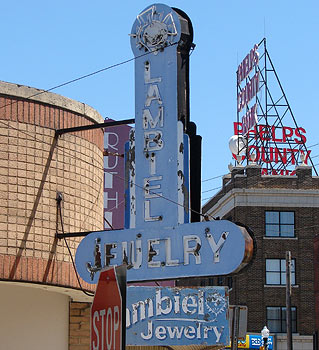
Very close-by is this cool old sign for Lambiel Jewelry, 218 W 8th.
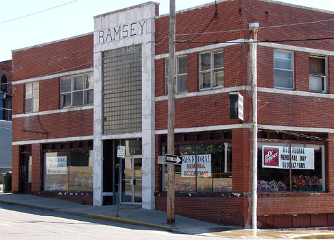
The Ramsey Building, 1000 N Pine, with its sizable area of glass brick, housed the Salvation Army Thrift store until recently. Now is hosts R & S Floral.
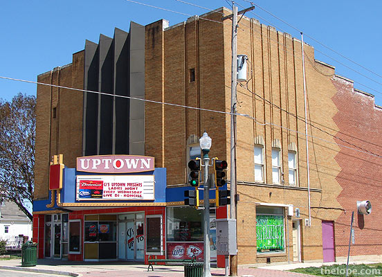
The former Uptown Theatre, 1100 N Pine St, is now a bar and grill. Read about its history at Cinema Treasures.
Pine Street intersects Bishop Avenue, and to go northeast on Route 66, we turn right and then curve left to go across I-44 and check out a small stretch of 66 that becomes an access road on the north side of the interstate.
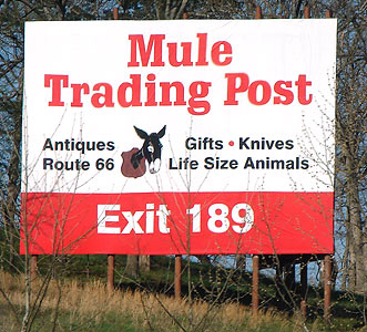
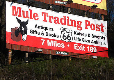
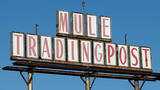
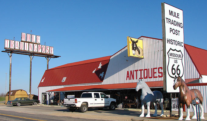
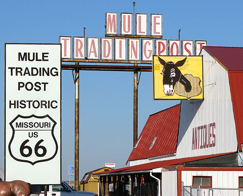
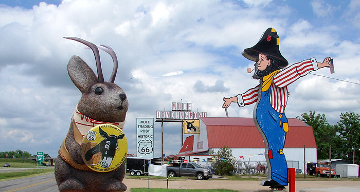
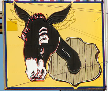
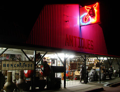
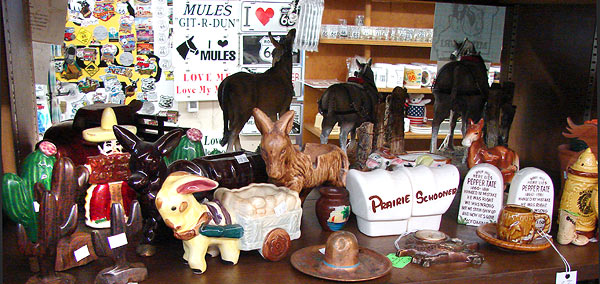
Mule Trading Post
At I-44 exit 189, on a dead-end stretch of Route 66, is the Mule Trading post.
Like Zeno's, the Mule is 50 years old, according to employees.
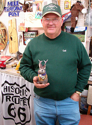
Carl smith, who with his wife, Velma, owns the Mule.
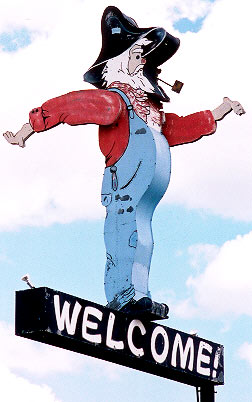
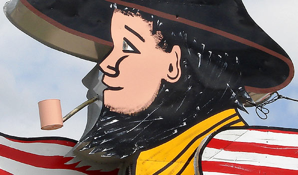
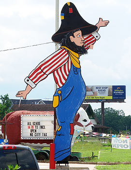
The Mule, under new owners Carl and Zelma Smith, has recently obtained a Route 66 relic to draw attention from I-44. This nearly two-story motorized hillbilly rotates his arms and has small flags hanging from each hand. The hillbilly is the newer of two that were made for the defunct Hillbilly Store, which started out near Devils Elbow, MO, on Route 66. However, this one was made after the Hillbilly Store moved closer to I-44.
By chance, I happen to have a photo of the Hillbilly Store's original sign which they parted with after commisioning the one that now resides at the Mule. I saw it in front of a store in Willow Springs, MO, along Hwy 60 sometime around 2001. I do not know if it is still there.
Back to the present day at the Mule: The newer hillbilly is considerably younger.
The sign currently has no lighting on it, but management of the Mule told me they plan to spotlight it.
A movie of the hillbilly:
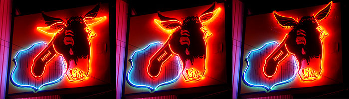
The Mule also has this nifty neon sign
The sign has a three-stage movement in the ears. When I saw it on June 2, the tubes in the middle of the face did not work.
I put together this night composite photo of sign "movement."
And here's a movie of the neon sign:
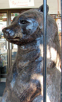
They really do have life-size animal statues.
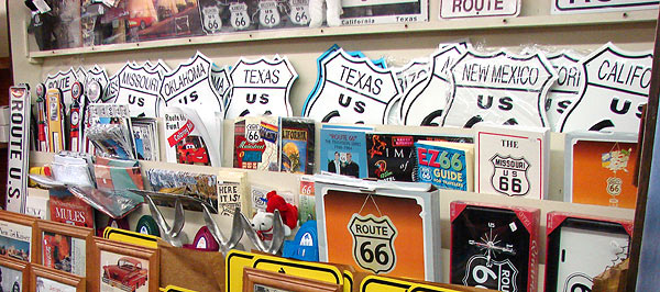
The Mule carries a nice assortment of Route 66 books...useful stuff, too.
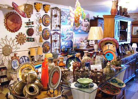
The merchandise here is a lot more like a suburban pottery place.
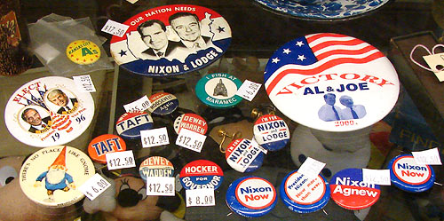
A nice collection of political buttons is displayed in a case.
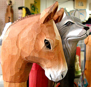
There aren't actually that many mules at the Mule. This is a cane head.
I'd be disappointed in a Missouri trading post if it didn't have some grandmother-ish ceramic brick-a-brak.
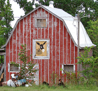
A storage barn
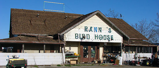
A short distance down the road, one finds Granny's Bird House. I had thought it said "Rann's" but a helpful reader pointed out the missing letters.
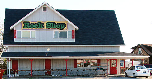
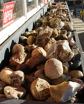
Rock Shops are too few these days, but here's one, down at the end of the dead end road.
A rock shop should have wooden bins of geodes and such, and this one does.
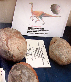
$295 will net you a Segnosaurs dinosaur egg from the late Cretaceous of China (90-95 million years ago).
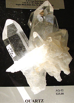
The quartz was more affordable.
Behind Ace you can see the posts that mark the end of this small stretch of drivable Route 66.
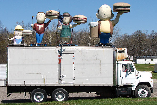
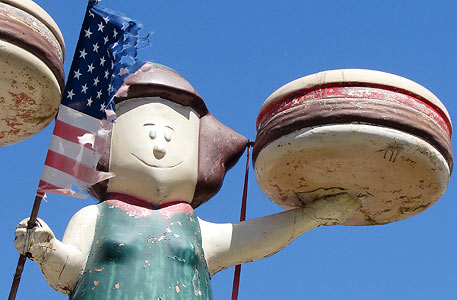
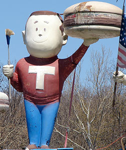
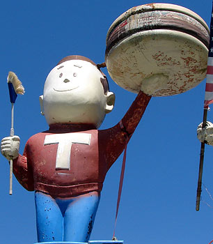
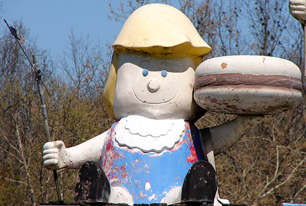
A&W family
Atop a truck in front of a building marked "Discount Groceries", sets a fiberglas A&W family. Students of roadside giants will know that the A&W family was made in the mid-1960s through early 1970s by International Fiberglass as revealed in on of the internets's true gems - an interview with former company owner Steve Dashew at roadsideamerica.com.
I know there are quite a few enthusiasts of these things, so I'll offer a few views.
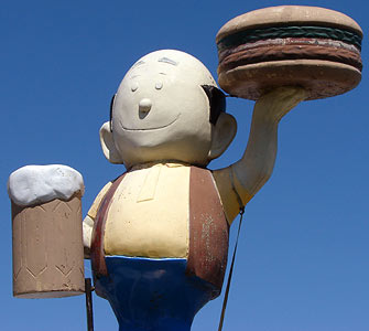
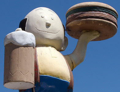
Papa Burger is the only one with a root beer mug. I've seen photos of other A&W family members with root beer mugs, but I don't know if it was standard.
Mama Burger
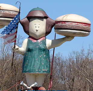
Mama Burger carried a tattered flag as if emerging from the ruins of a cataclysm with motherly reassurance and comfort food.
Teen Burger
Baby Burger
For more information on the whereabouts of surviving members of A&W families, see agilitynut.com. The webmaster of that site refers to the business as "Goodies Discount Grocery" and her photos show a sign to that effect on the trailer. However, when I was there on March 8, 2007, there was no sign on the trailer at all, and the building behind was marked "Discount Grocery."
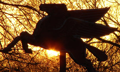
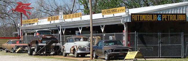
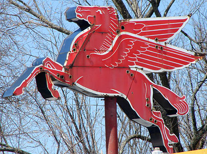
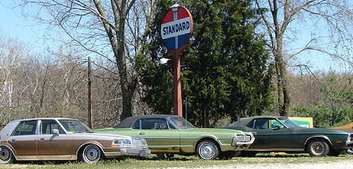
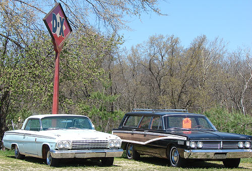
On down Route 66 a bit, lies Route 66 Motors, which has this fine Mobile Pegasis.
Even though my maps show it to be outside the Rolla city limits, I have included it here because its address is 12651 Old Highway 66, Rolla.
Mobile Pegasis in daytime
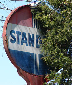
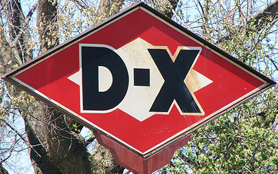
A Standard Oil sign peeks from the trees.
DX sign
I don't know if the cars are for sale or show.
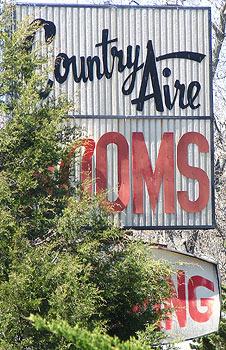
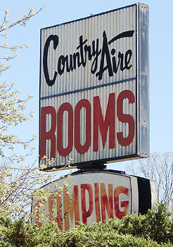
On east down Route 66, possibly not still in Rolla, the sign for Country Aire rooms and camping is half hidden in the trees, and some of the letters could use help.
The other side is a slightly better.
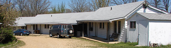
This is another of those motels that may have nice been a cozy overnight stay for the family on Route 66 and is now apparently a long-term stay place.
The Mother Road goes on, and so do we. But the next cool thing I saw - a neon dripping faucet - has a St. James, MO, address and this post is quite long as it is. Another time, perhaps?
Today is National Electricity Day, also known as Go Fly A Kite Day - the approximate date in 1752 on which Ben Franklin had some fun outside in a storm. I can't find much to link to concerning this; I've seen the date primarily on teachers' calenders. Ah well, have some jolts.
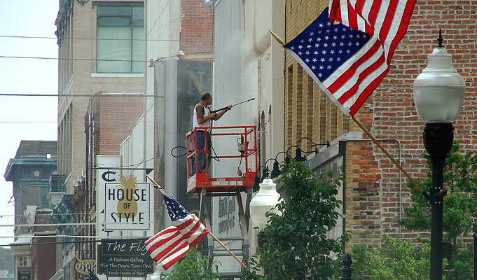
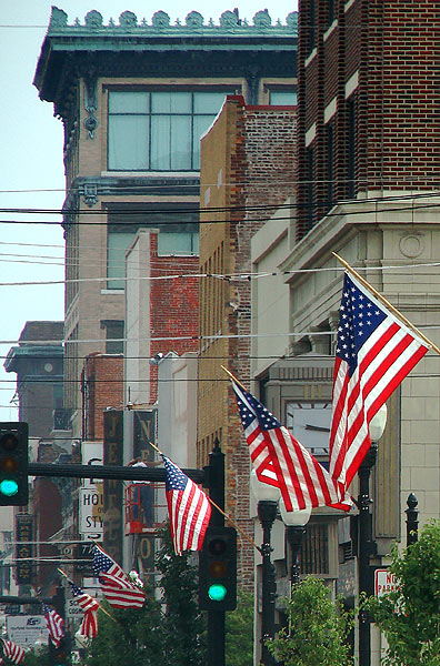
Flags waft in the breeze as a worker cleans a building on Main Street in Joplin, MO, in the 400 block of South Main Street along the short stretch that also qualifies as Route 66.
Today, June 14, is Flag Day here in the U.S. of A. The holiday (technically, National Flag Day) commemorates the adoption of the flag of the United States on June 14, 1777 by resolution of the Second Continental Congress.
You didn't get a day off today because Flag Day is not an official federal holiday, however, Pennsylvania does celebrate it as a state holiday.
The tall, ornate building in this view looking south is the Newman Building (built about 1910) at 602 South Main Street, one block from where Route 66 turns west onto 7th Street.
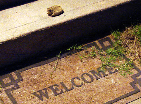
My friend Patsy has a guard toad. I was checking on her house while she was out of town earlier this month and found her amphibian watch-critter.
Here he/she is in context, on her porch step.
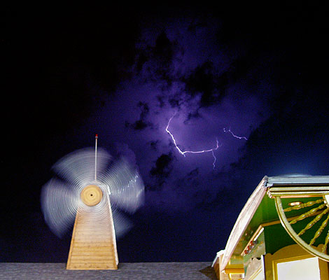
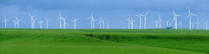
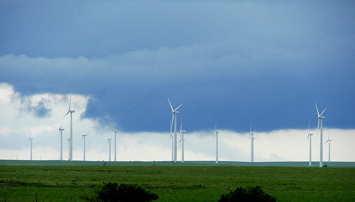
I've been zipping back and forth between KS and MO of late, and on the first of this month I stopped at the rest stop on Hwy 400 near Beaumont KS to watch the sun play across the Elk River Wind Farm with the storm clouds that seem ever present of late.
See the cows? They give the 100-unit wind farm a bit of scale. The windmills are 389 feet tall at the top of the highest blade position. The farm takes up 7,907 acres, which are owned by five local landowners. The land is tall grass prairie and is used to graze cattle. The fact of the wind farm's placement on this prairie gave rise to some controversy.
I've been looking into investments in wind power of late, though a speaker at a recent energy conference in Tulsa told me there are seldom opportunities for the small investor in such projects. This particular wind farm was finished in late 2005 by Elk River Wind Farm LLC of Larkspur, CA, HMH Energy Resources of Larkspur, CA, and Greenlight Energy, Inc. of Charlottesville, VA. It was then sold to PPM Energy, Inc. of Portland, OR, who signed a 20-year deal to sell 150 megawatts of electricity to Empire District Electric Company of Joplin, MO. Empire estimates it can meet the annual electricity needs of about 42,000 homes with the purchase.
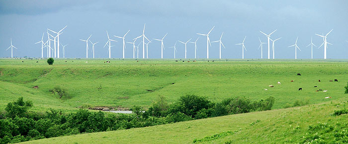
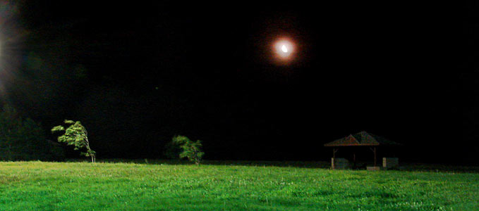
A few nights later I sought refuge from one of Kansas' occasional freakish straight wind storms at the same rest stop. I slept for a while in the car as it was rocked by frequent 45mph gusts with a few that that were stronger than that thrown in, just for variety. During a calmer period, I tried to get a photo that would show the degree of wind.
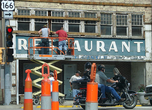
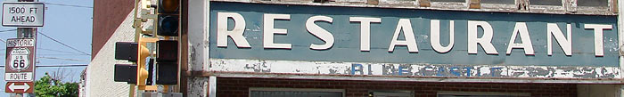
On Saturday the 9th of June, I took a little drive on the Kansas stretch of Route 66. Work was taking place on a building on the NW corner of Highways 166 and 69 (Rt66) in Baxter Springs.
Lettering underneath "restaurant" seems to read "Blue Castle."
While driving north on RT66 from Baxter Springs, I ran across a parade for Riverton Kansas' 9th annual Route 66 Celebration. The parade ran the entire course of Route 66 in Kansas, which is about 13 miles.
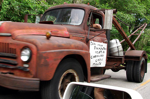
I passed the tow truck that helped inspire the Disney/Pixar "Cars" character of "Mater."
I turned around and decided to follow the parade. As cool as it was, I found the watchers more interesting. It reminded me of seeing people from a train. This gentleman is north of Baxter Springs.
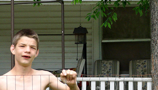
This young man watched from his yard in the north part of Baxter Springs.
Baxter Springs
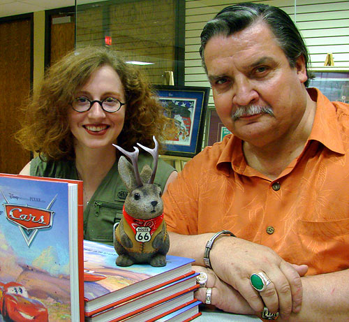
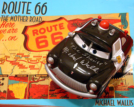
The Grand Marshall of the parade was author Michael Wallis, whom I found later in Riverton. I'd wanted to meet him for some time, so I was happy to get his photo with Ace Jackalope. I was doubly pleased to see fellow blogger and enthusiast of many cool things, Emily, aka Red Fork Hippie Chick in his company.
Mr. Wallis was kind enough to sign a toy Sheriff car for me; he voiced the character for "Cars" and also served as consultant for the movie. The sheriff patrols atop my well-worn copy of his book "Route 66 - The Mother Road." I still look through that book before beginning any Route 66 trip of significant size. Wallis will attend the annual Route 66 Festival in Clinton Oklahoma, June 21-24.
Emily thought it'd be fun to do the classic "you shoot me, I shoot you" thing. She was right. See her version in this blog entry here...pretty neat stuff, marred only by the inclusion of a camera-wielding dweeb, albeit in a cool shirt.
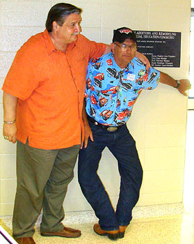
Dean "Crazy Legs" Walker was also in attendance. Here, Wallis helps Walker attain the weird foot posture that he'd shown me last year at the "Cars" premier at the 66 Drive-In Theatre in Carthage, MO. Walker is credited as being an inspiration for the "Cars" character, Mater.
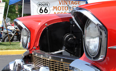
I was reminded, just as I had been a weekend prior in Rolla, that cars used to look cooler.
It rained rather much in Joplin on the 12th of June. Here's what happens when you use flash on a shallow puddle on a sidewalk. If one colored this in photoshop, it'd make a nice 60's acid rock background.
A bunny finds partial shelter from the rain by a mailbox.
After the rain, the bunny changes it's posture and "de-puffs", as it were.
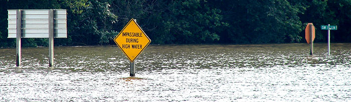
Tuesday night my lovely significant other and I had to drive to Kansas City from Joplin. By that evening, rain had caused flooding in SW MO. This is Hwy 126, west of where it intersects Hwy 71 south of Lamar in SW MO on Tuesday evening, June 12.
I've been accused of late of being a harbinger of floods.
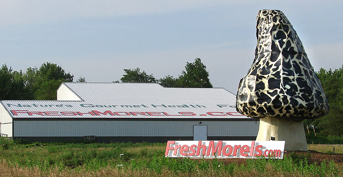
Giant things are cool; one should always photograph them. I'd seen the Freshmorels.com giant fungus before, but had never been able to stop for it. It's near Nevada, MO on the east side of Hwy 71.
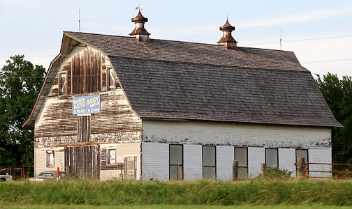
I had a long conversation with Patsy Terrell about barns recently. She'd returned from a trip to her native Kentucky with a renewed interest in photographing vintage ones, and got me thinking I should do the same before more of them are made of metal or gone altogether. This one has a sign advertising Koehn's Auto Body Repair in Rich Hill, MO, and was on the east side of Hwy 71 near that town.
Winstead's is a Kansas City fast-food chain, and its trademark architecture includes this spire.
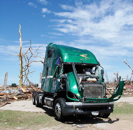
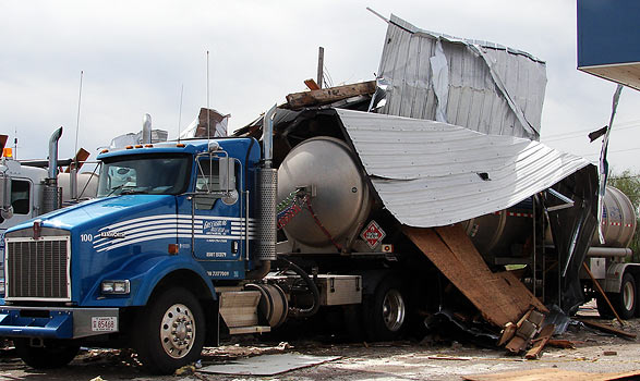
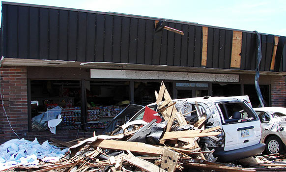
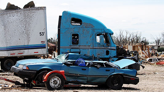
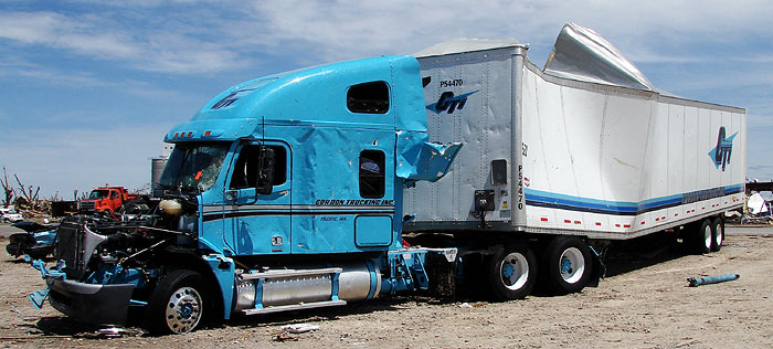
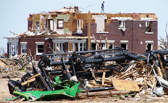
The pretty green truck reminded me of a wounded June Bug - its dislocated fender a wing shield askew. Though the drivers were no longer present, a reporter with whom I was working, Charlie Morasch of Land Line Magazine, was able to get the truck's story:
First the cab rocked to the left, then to the right. It rocked the green Freightliner so hard Donna Price thought the wheels were being ripped off. "Here we go," Donna told husband Larry as the truck and loaded trailer lurched one way. "Oh God help us," she cried out as it lifted into the air. The tornado’s 205-mph winds carried the truck across four lanes of U.S. 54 and slammed it on its driver’s side. An instant later, the truck went airborne again and dropped on the passenger side, wind shattering the glass. "Larry, are you OK?" Donna called. Her heart skipped a beat during a brief silence. "Are you OK, Donna?" Larry called out.
- from an interview with Larry and Donna Price, conducted by Charlie Morasch for Land Line Magazine, for which I took the photos on this post. It is by their permission that I release them here.
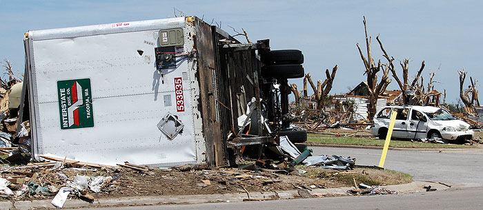
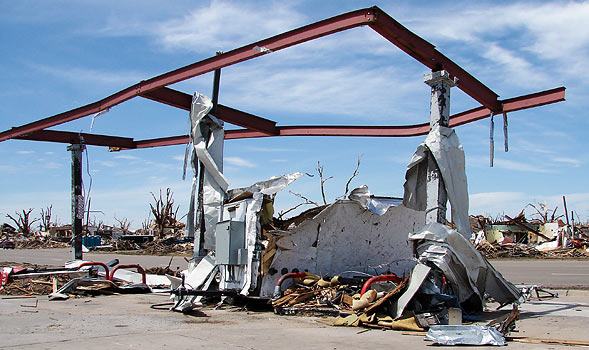
Here's the Price's trailer; the tractor seen in the top photo had been righted by the time we came across it on May 8; the tornado was the night of May 4.
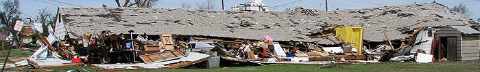
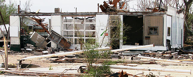
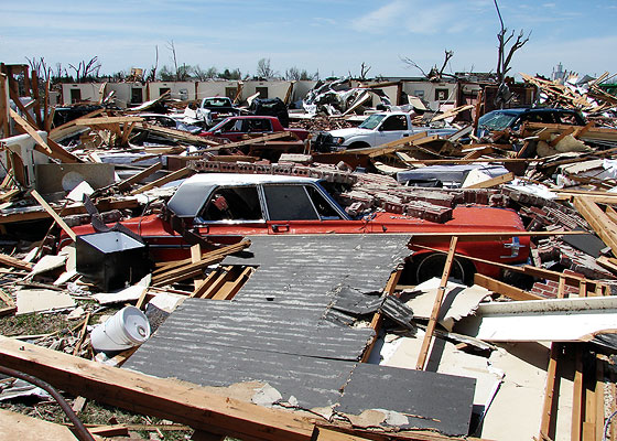
I'm running this post in response to the number of people - truckers, mostly - who have expressed an interest in seeing more Greensburg photos since the publication of the June 1 Land Line magazine. I hope it answers a few questions.
I've already shown four sites along this route - Dillon's, an old Sinclair station, Cowboy Supply Company and a western town - in Greensburg Before and After. Highway 54 is also Highway 400 through Greensburg, and the local street name is Kansas Avenue. Names change slowly in these parts and the common name of the street is "54" rather than the relative newcomer, Highway 400.
This was the first structure we saw as we entered Greensburg from the east on Hwy 54 on May 8. It looks as if the roof had collapsed and was held up only by the merchandise in the building. You can see what looks like a side entrance alcove, which looks pretty much intact.
I hope there is a study by engineers of the damaged buildings in Greensburg. A shelter or basement is best of course, but what of those structures which had no basements and were only partially destroyed? What parts of those survived best?
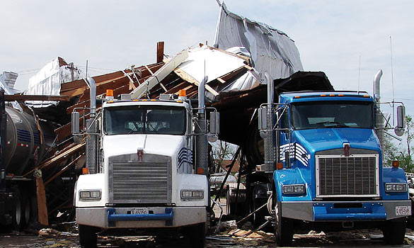
These three trucks were on the south side of 54, on the eastern edge of town.
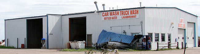
This car and truck wash didn't look too damaged.
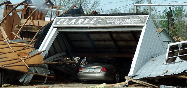
Clarke Oil Field Services did not fare well.
This is one of several buildings along hwy 54 on the east side of Greensburg that looked like old gas stations. It is on the south side of Hwy 54. Notice the poles are all bent the same way - to the west. It would be interesting to make a map of Greensburg, noting the directions of such bending, and compare it to what one might expect from the Coriolis effect, which partially explains the motion of tornadoes. I've always been a little too physics-dense to properly understand the Coriolis effect, but it largely explains why most tornadoes in the northern hemisphere spin counter-clockwise. I might expect poles on the opposite side of the path of the tornado to be bent the other way, but then, I'm some guy with a blog, and not a physicist.
This is another building, similar to the one above.
This structure was on the north side of 54, on the east side of town, but near Main Street.
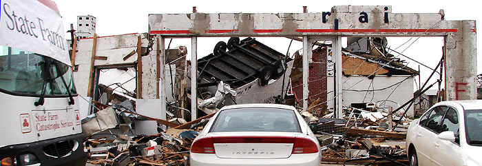
I've little idea what this building on the NE corner of Main Street and Hwy 54 was, but State Farm set up a mobile claim office in front of it.
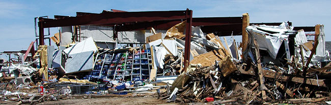
Moving on to the west side of town on Hwy 54, this is the Kwik Shop mentioned in Greensburg Before and After. It looks as if something has been embedded in the structure at the top center.
The tornado left a lot of skeletal support structures like this Kwik Shop canopy.
This is the remains of Coastal Mart. In contrast to Kwik Shop, the building was pretty much gone. I have found this Coastal Mart to be listed as a truck stop in several directories, so I think it might be the one a commenter on one of my other Greensburg posts was asking about. It's in the 400 block, west of Main Street, on the north side. There was also a Conoco nearby, which is listed as a truck stop in some directories.
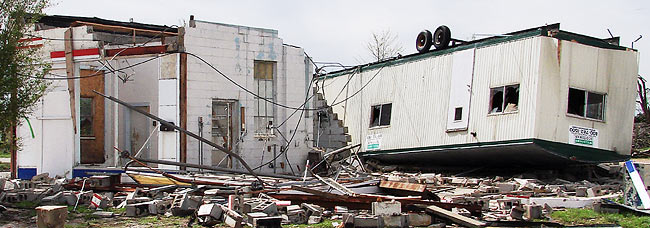
Here are some more scenes from west Highway 54 in Greensburg:
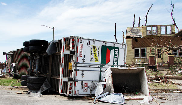
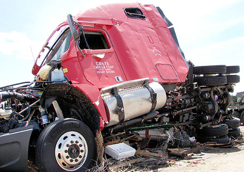
This truck, as well as the Price's, was found in about the west 700 block of Hwy 54 on the north side.
Note the twisted frame.
Yet another ill-fated truck
This was across the street from the parked trucks.
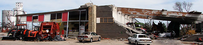
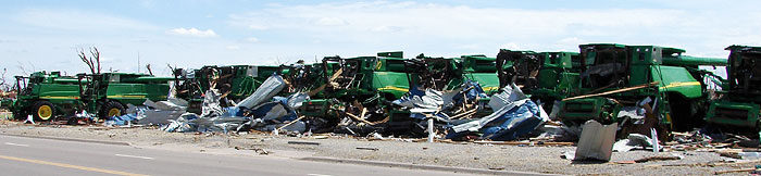
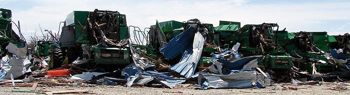
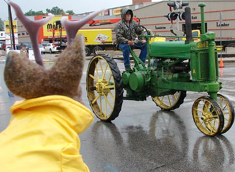
Greensburg Tractor & Implement, 721 W Kansas Ave is a large dealer of John Deere tractors and equipment.
This is as far west as we went; I am told the damage did not extend much farther.
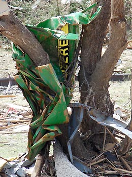
There were tell-tale scraps of John Deere Green found far from the sales lot, but I don't know if they originated there. This one was a few blocks north
Some scenes along Highway 54 in Greensburg were used in a televised interview CNN conducted with me. See it here. See also my CNN I-report, here.
I was interviewed yesterday by Scott Leith of the Atlanta Journal-Constitution newspaper about user-generated content on sites such as CNN.com. I'm the Kansas photographer they mention near the bottom of the article, concerning the Greensburg photos.
I've never been to Atlanta, but I understand Coca Cola is an important part of its history. I remember this every time I see a rerun of that Futurama episode in which they visit the lost underwater city of Atlanta in which people have evolved into mermaids and mermen, the evolutionary change having been accelerated by the caffeine the water. I'm sure the Atlanta tourism commission would rather the city come to mind another way, but I say "whatever works."
I thought it particularly neat that the Futurama episode worked in the Donovan song "Atlantis" with reworked lyrics. The original song uses the term "antediluvian", meaning "before the (biblical) flood", which I always got a kick out of seeing applied to dinosaurs in Victorian science journals (and shudder at seeing applied to them by creationists).
Sorry to digress - I hear Atlanta is, in reality, a nice place...and far from being underwater, is probably a darn sight dryer than Kansas of late. I'll have to go there; and Ace already has the wardrobe. Here's the article.
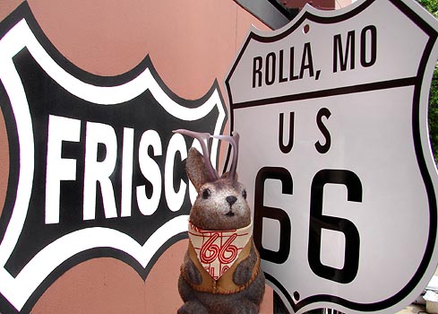
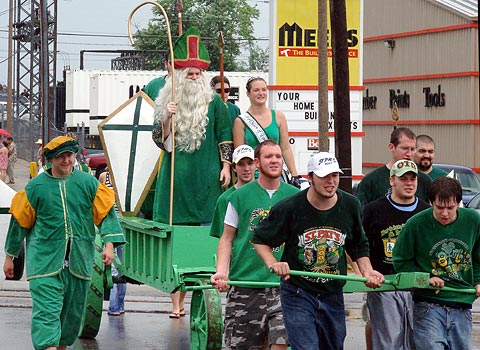
We attended part of the Route 66 Summerfest in Rolla, MO this past Saturday. There actually wasn't much that was Rt66-oriented about it but I did pick up this cool souvenir metal sign for five bucks.
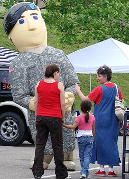
A giant inflatable-suited soldier patrolled the art and craft show.
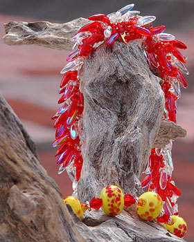
Perhaps he was guarding this beaded jewelry by Magpie Designs of Joplin, another Route 66 city.
Although it rained, that isn't what was falling on this young man; a fire truck sprayed one part of the street constantly.
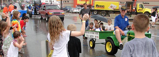
A parade started at 11AM...so did the rain.
Some didn't seem to mind the rain.
Others did.
Elsewhere in the town, there had been a live tableau exhibit. I presume this gentleman might have been part of it. Rolla is a geology town due to the presence of the University of Missouri.
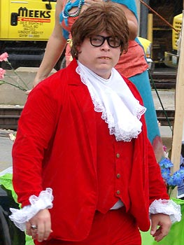
Shag-a-delic, baby!
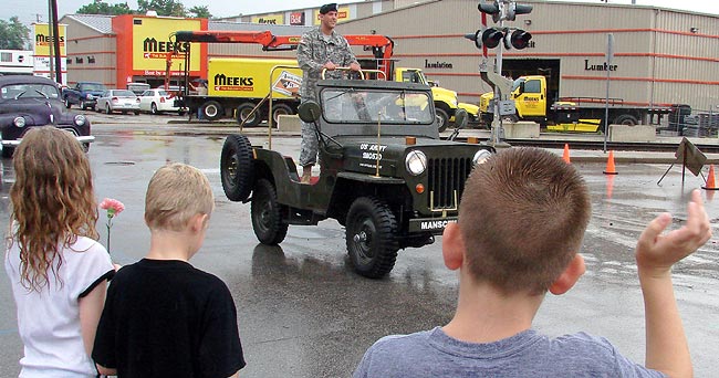
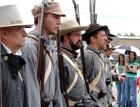
And to balance out the hippies: soldiers. Wow, it really is like the 60's.
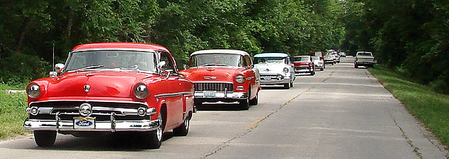
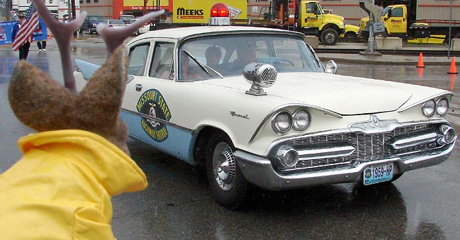
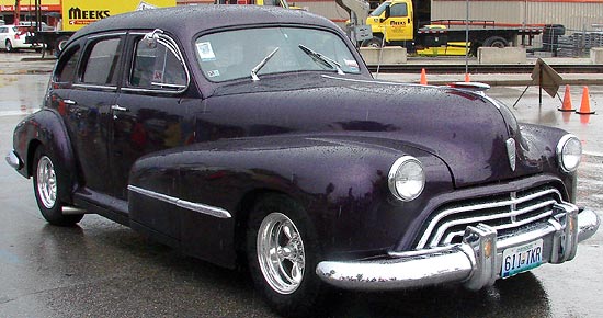
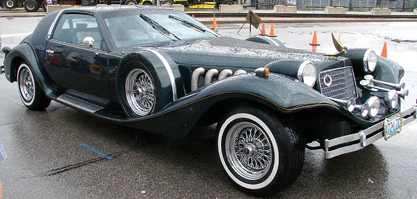
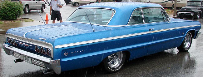
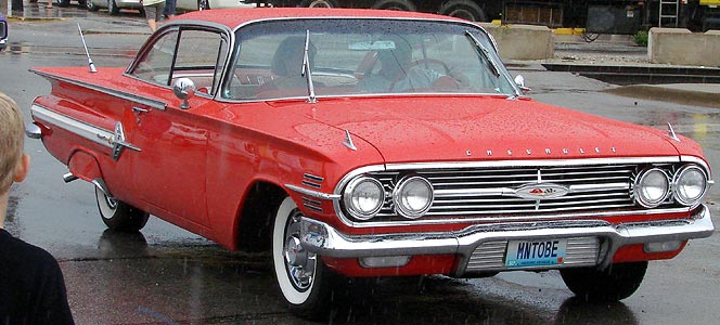
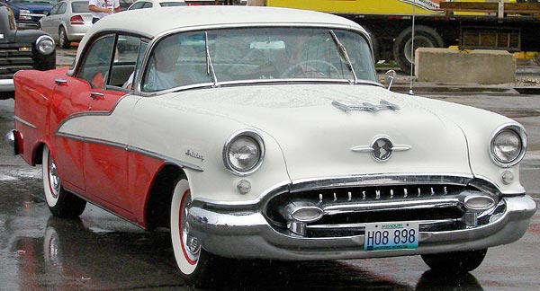
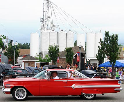
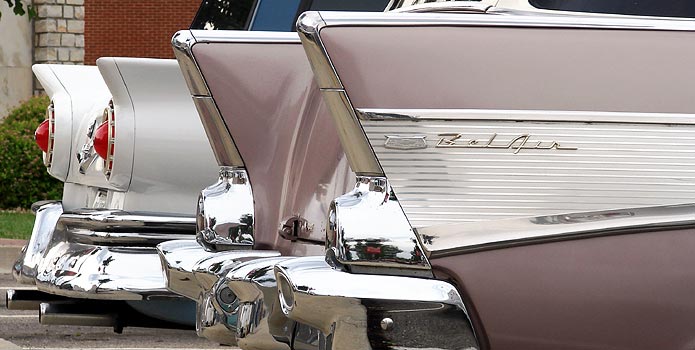
Neither Ace nor I know anything about cars, but reader feedback shows that a lot of you like them, so what follows is a small gallery of cars from the parade.
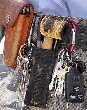
This guy had a holster for his corn cob pipe. I asked him about it and he explained it was a maglite holder.
After the parade and craft show, cars accumulated in a lot between 9th and 10th near Elm Street.
When photographing in the Midwest and looking for a background, if all else fails, use the grain elevator.
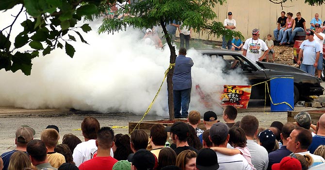
This event puzzles me. It was a ritualistic ruining of tires called a "burn out." Cars were fastened in place and spun their tires, creating lots of smoke. The crowd, some of whom were engulfed in fumes, applauded.
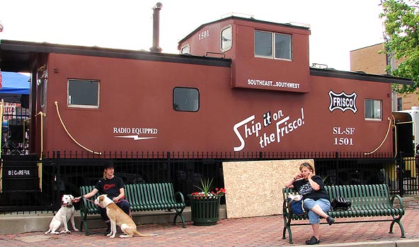
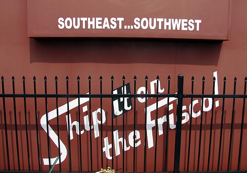
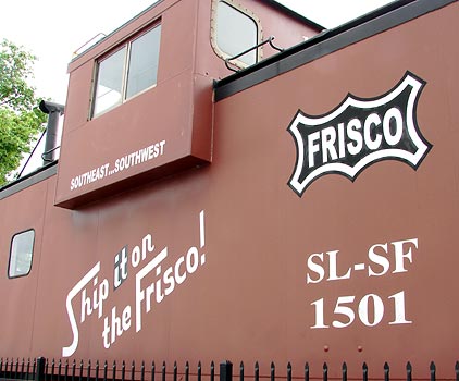
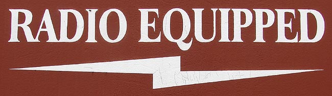
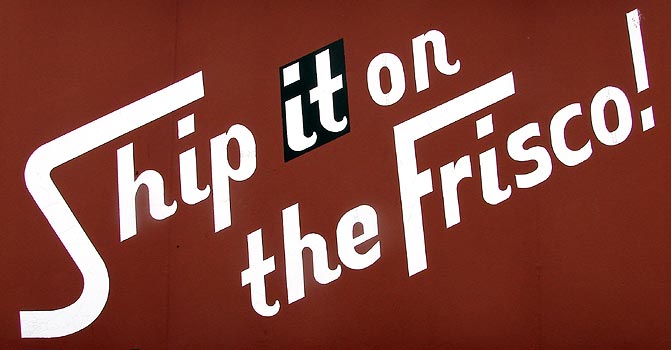
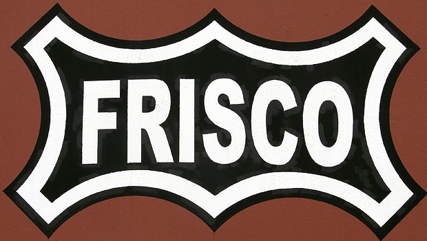
Rolla utilizes a Frisco caboose as an information center. That now-defunct railroad figured prominently in the history of the town.
For my railfan and model railroader friends, I present a few close-ups for you to enjoy of Frisco caboose number 1501.
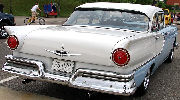
A final note - Like I said, I know little about cars, but this I do know: America truly lost something when cars shed their fins.
From his base in Hutchinson, Kansas, Ace Jackalope ventures forth - sometimes to foreign lands and sometimes to his own backyard - in order to drink in the wonders of the world around us.